With 10 days planned in Newfoundland, my focus was on the Newfoundland & Labrador Folk Festival in St. John’s and Gros Morne National Park. I spent 3 days / 2 nights in St. John’s and five days at Gros Morne NP. The other 2 days were spent traveling about the island.
I really liked the people and geographic diversity of Labrador. One could have easily spend a month or more on the Island. As usual, so little time to see so much.
Ferry Ride
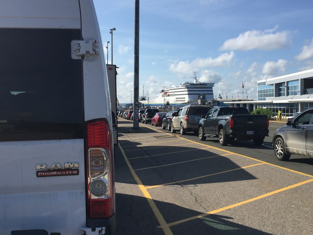
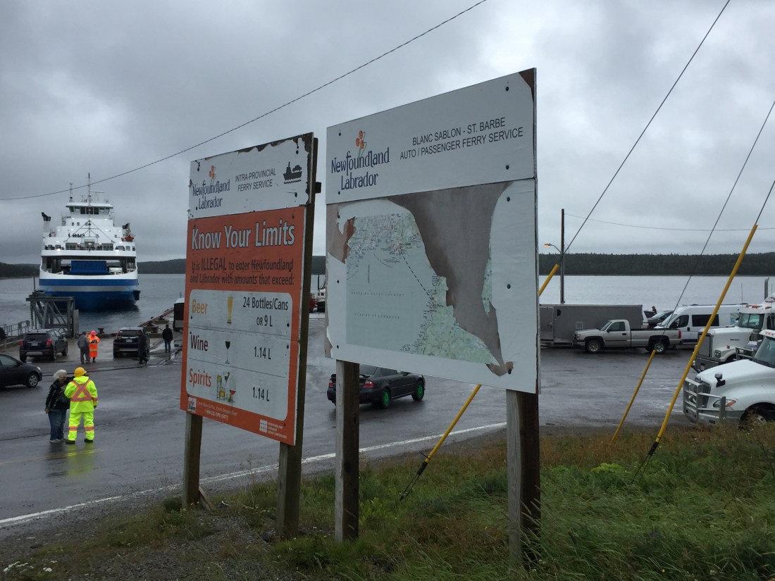
From Nova Scotia (Sydney), there are two ferry options. With a little imagination, you can see Newfoundland shaped roughly like a T-bone steak, with the T sitting on the west side of the island and the meat of the steak on the east side. You can tell I am writing this prior to supper.
The first ferry option takes you to the bottom of the T (Port aux Basques). The second option takes you to the east side of the steak (Argentia). The first option takes around 5 1/2 hours and the second option 14 hours. These times are the estimated travel time between ports. The loading and unloading process adds more time, so plan accordingly.
I chose the first option which allowed me a shorter ferry ride and then to see some of the lower western section of the island.
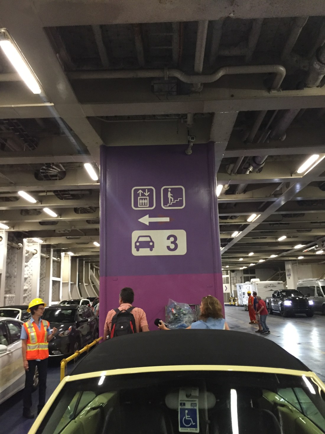
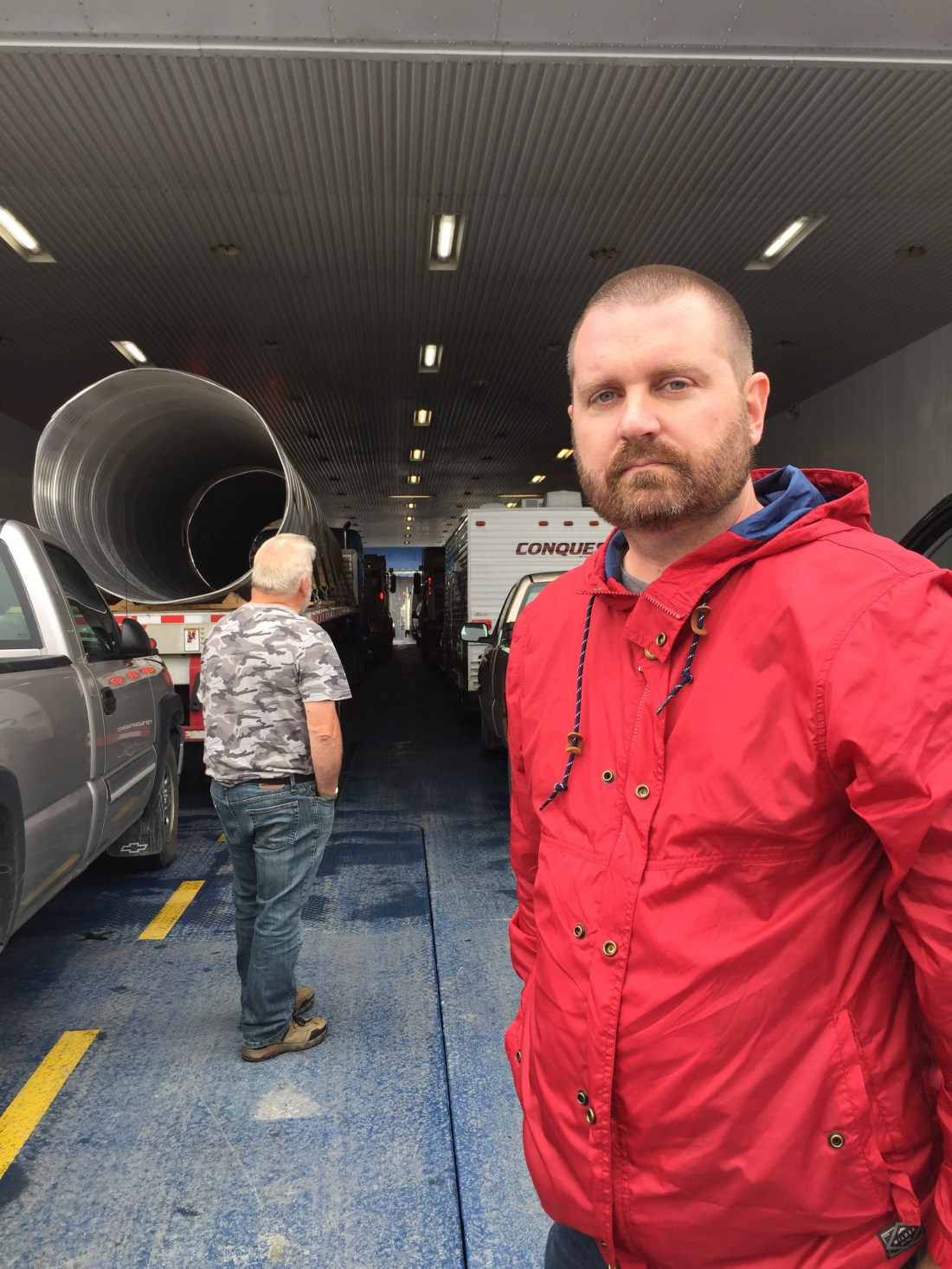
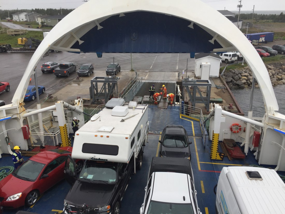
Waiting to load (very big ferry):
Loaded on the ferry and ready to head up to passenger area. Everyone must leave their vehicle and stay in the passenger area during the trip between ports.
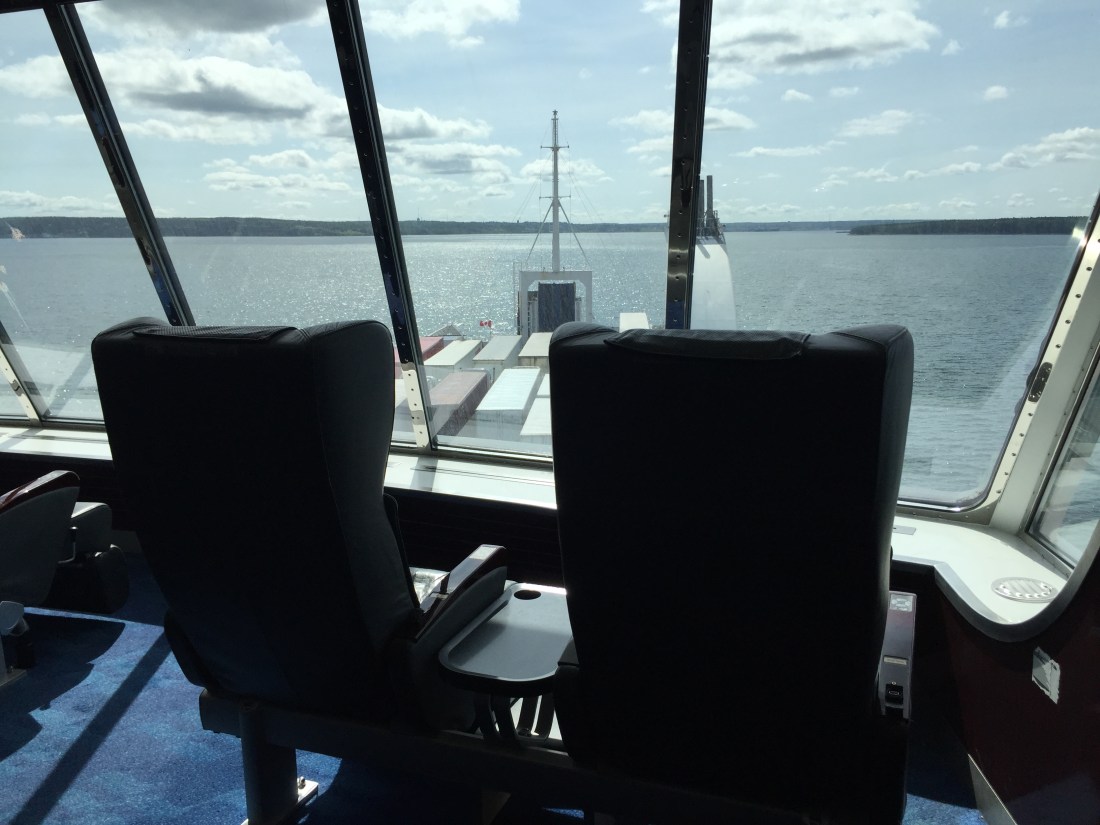
You can reserve seats for the crossing which are very comfy. My seat was the one on the right.
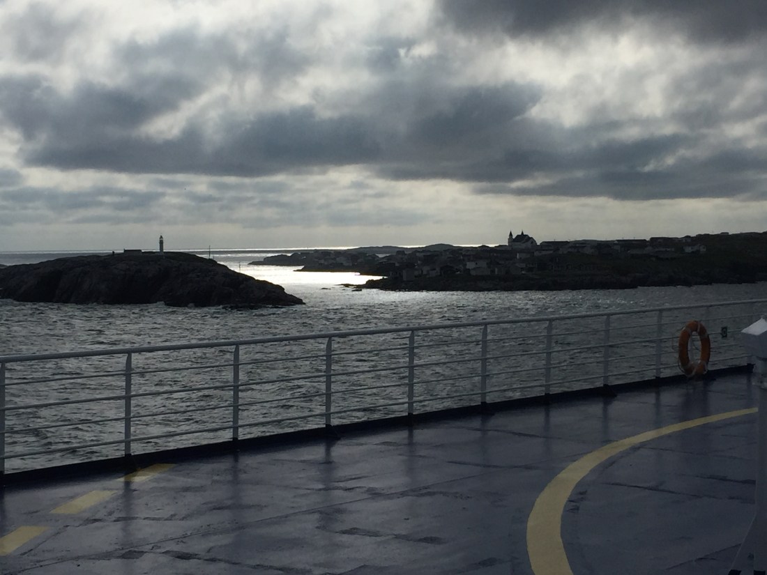
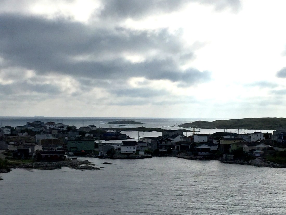
Pics of Port aux Basques from the ferry:
After unloading from the Ferry around 6:30 pm, I headed to Stephenville to camp for the night at the local Walmart. The next day I spent driving through the heart of the Island and then camped in Gander (at the local Walmart) along with over 20 other camping vehicles.
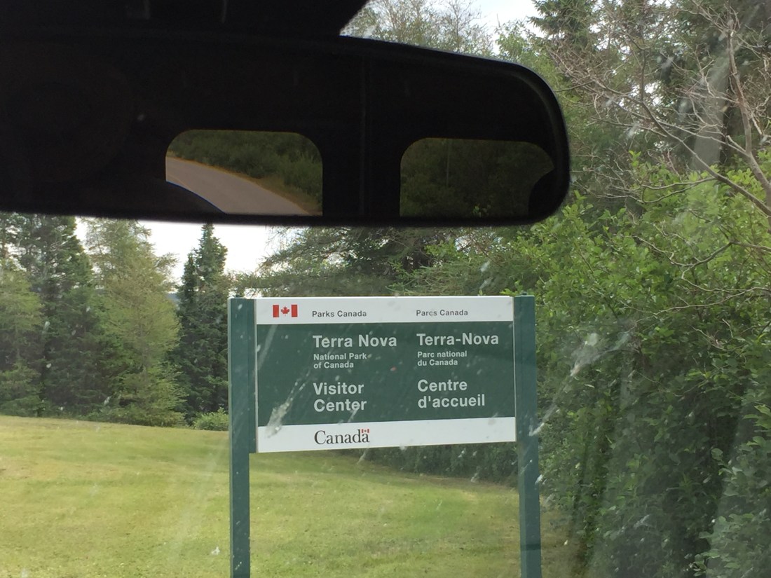
I was up early the next morning and covered a lot of ground before getting into St. John’s. My travels that day focused on Terra Nova National Park and also the attractive little village of Trinity.
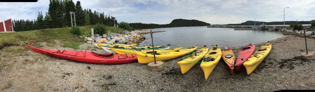
Terra Nova National Park
Terra Nova offers numerous hiking trails and kayaking options. Some pics:


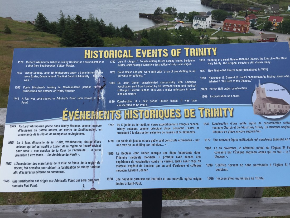
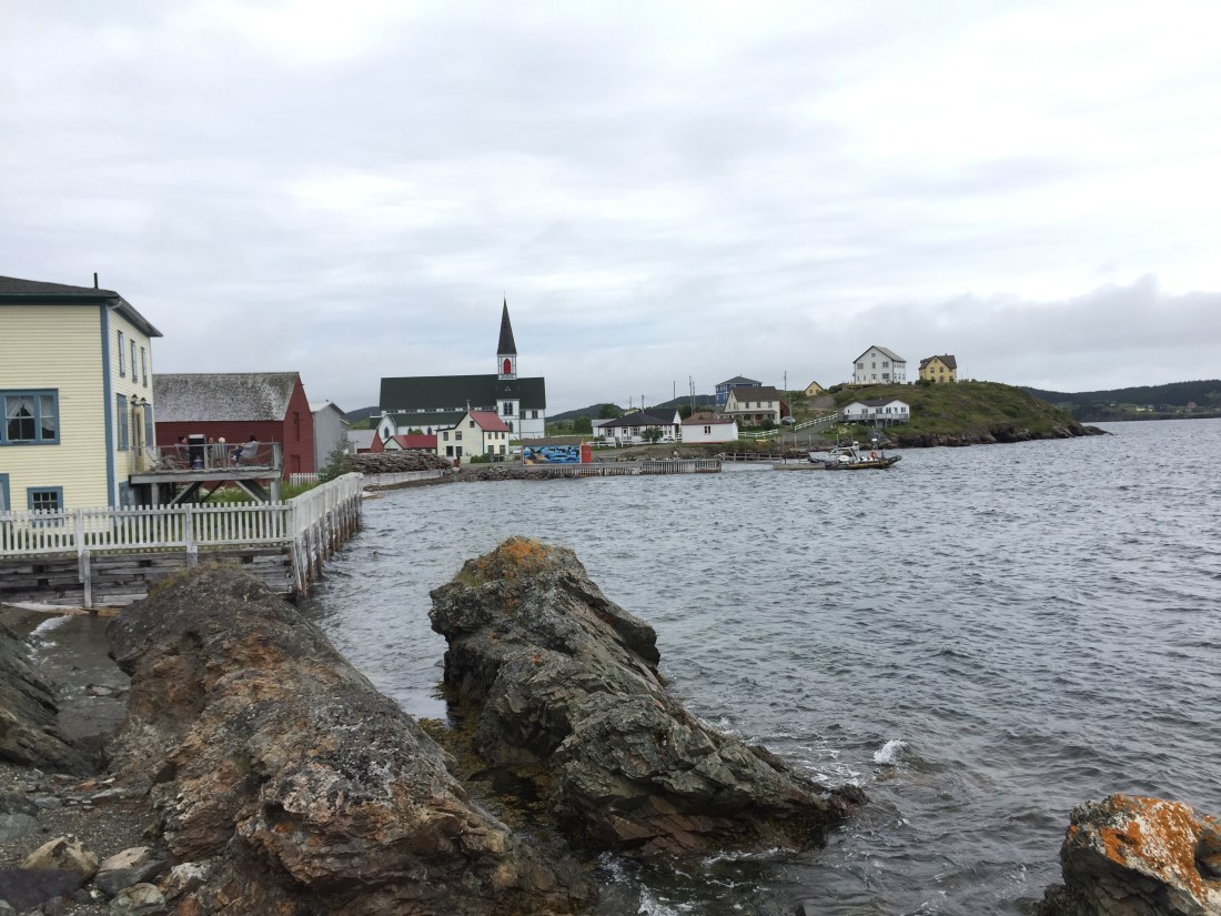
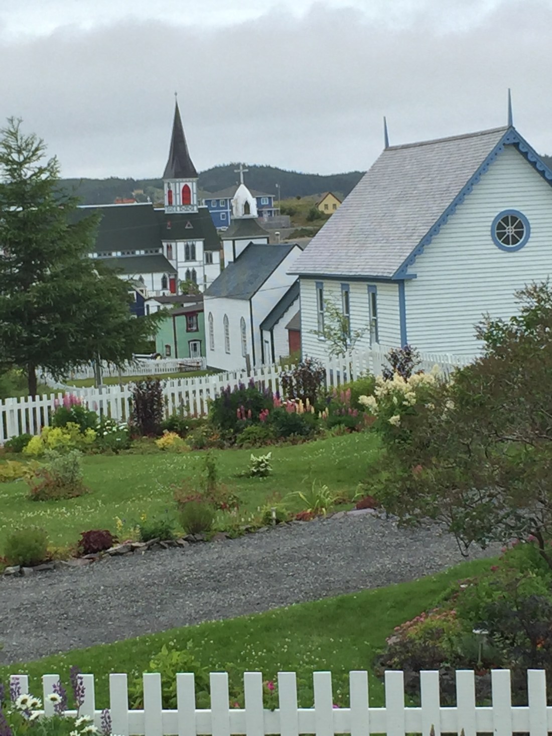
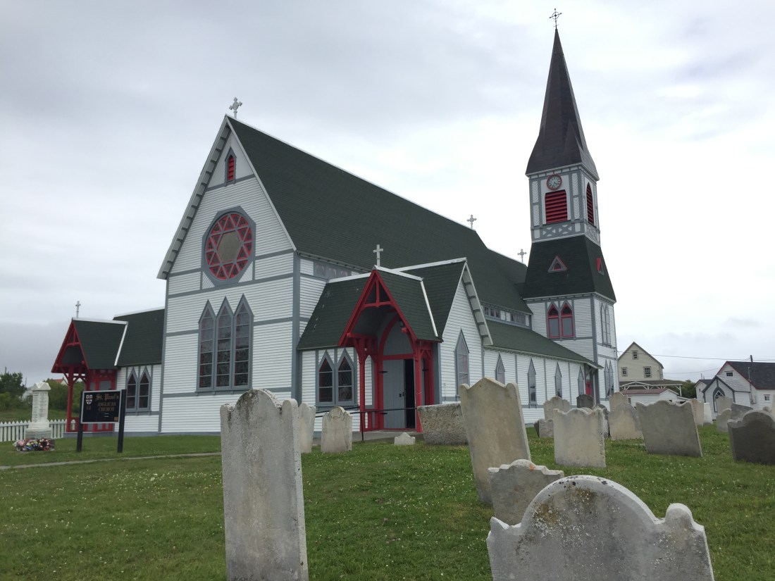
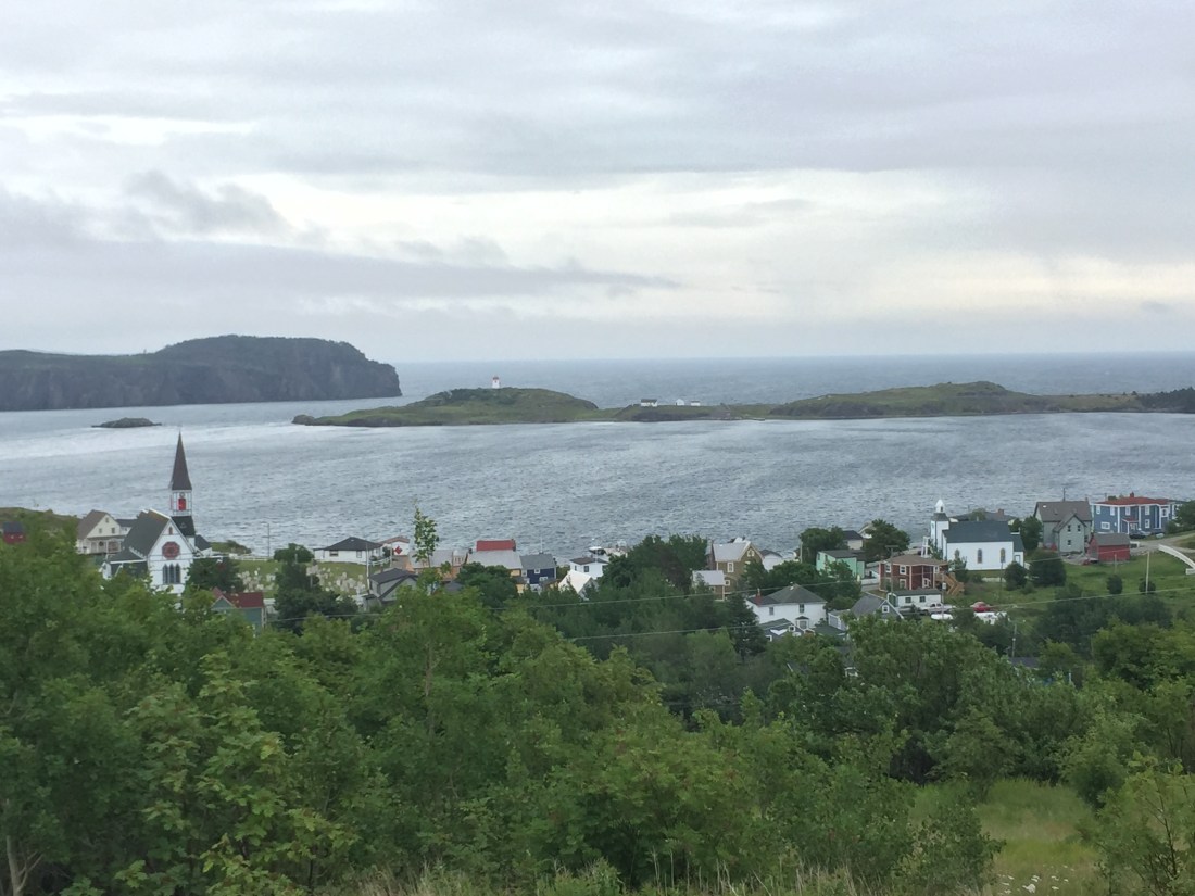
Trinity
In the early 1500’s Portugal, Spain, French and English were exploring the waters of North America. In 1501, a Portugal Captain discovered Trinity Bay while looking for a water passage to China. In 1558, English merchants founded a settlement on the bay. The look and feel of the village has changed little since the 1800’s. You can easily spend a 1/2 day in the village which has accommodations, restaurants, museums, hiking trails, etc.
Some pics of the village:
The Gun Hill trail takes you to a view above the village and is well worth the go.
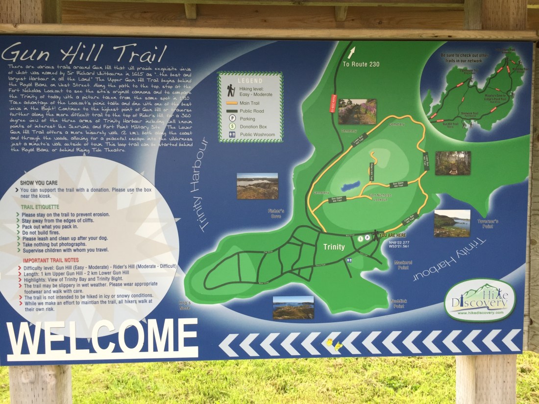
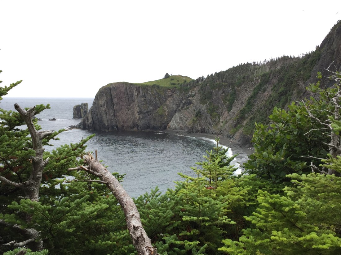
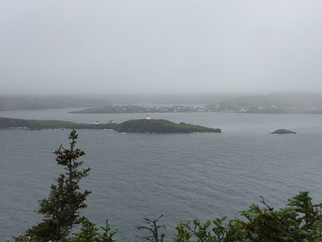
The view from Gun Hill. Note the stretch of land beyond the lighthouse. Another trail called the Skerwink trail is located there.
Skerwink Trail
This is a “Just Go” trail. When weighing effort versus reward, you will never get a better payback.


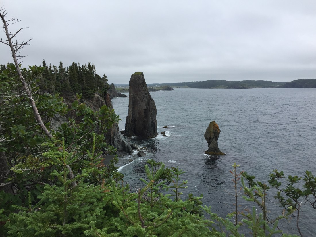
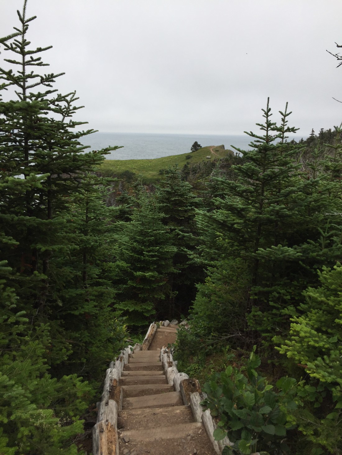
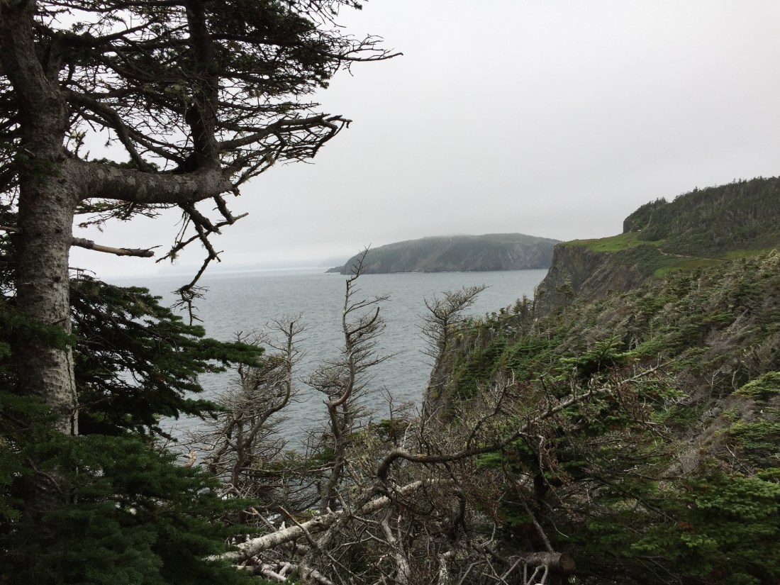
Looking back toward Trinity from the trail:
I understand that there are two trail heads off of the main Skerwink loop trail. One has just a parking area and the other has parking and a brewery. I only found out about the brewery option after finishing the hike.
There was a donation box at the trail head. The money went toward trail maintenance. I gladly added to the box just as a gentleman was coming to empty it for the day. We talked and I “pulled out” of him that he was a key person for the planning, building and maintaining of the trail. A really humble individual. I complemented him of the accomplishment. Somewhere along the line of conversation, a couple of beers appeared from my cooler and we continued to talk for quite some time. Life on the road.
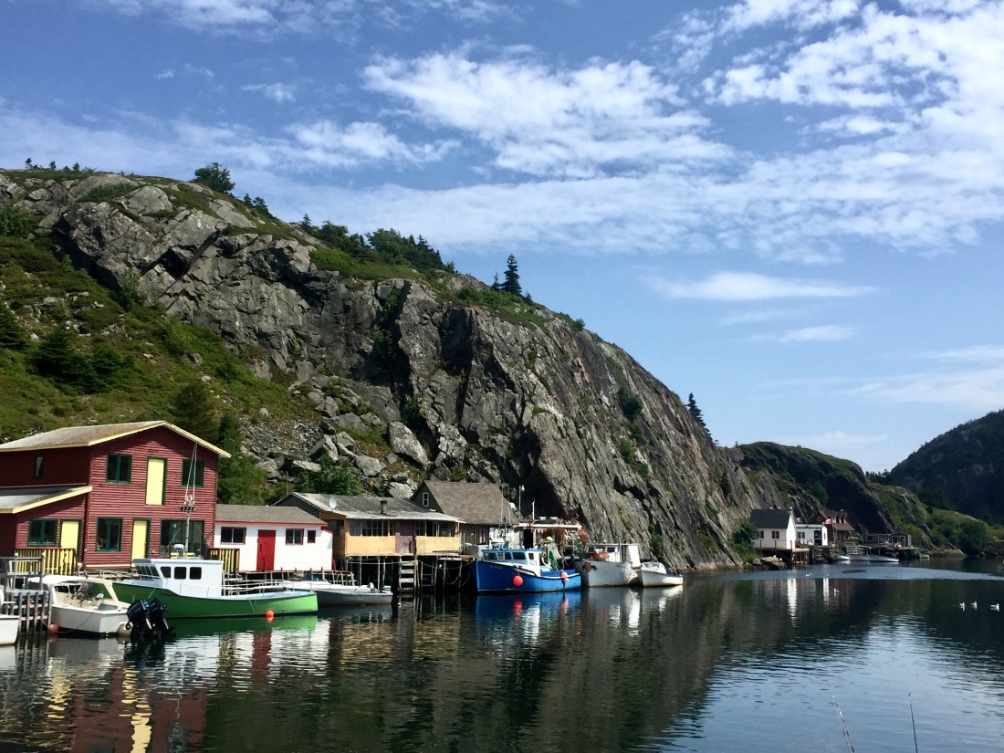
St. John’s
The founding of St. John’s (the capital city) goes back to the 1500’s. Ownership of the area changed hands (by war) a number of times among various European Nations. I really liked this city and what it offers. I would have loved to have more time to investigate and absorb. I will be back.
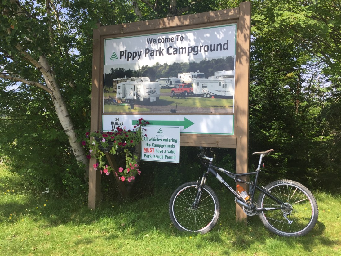
I camped at Pippy Park preserve which is located on a hilltop plateau overlooking St. John’s. The downtown area is about 3 miles and easily accessed by bicycle.
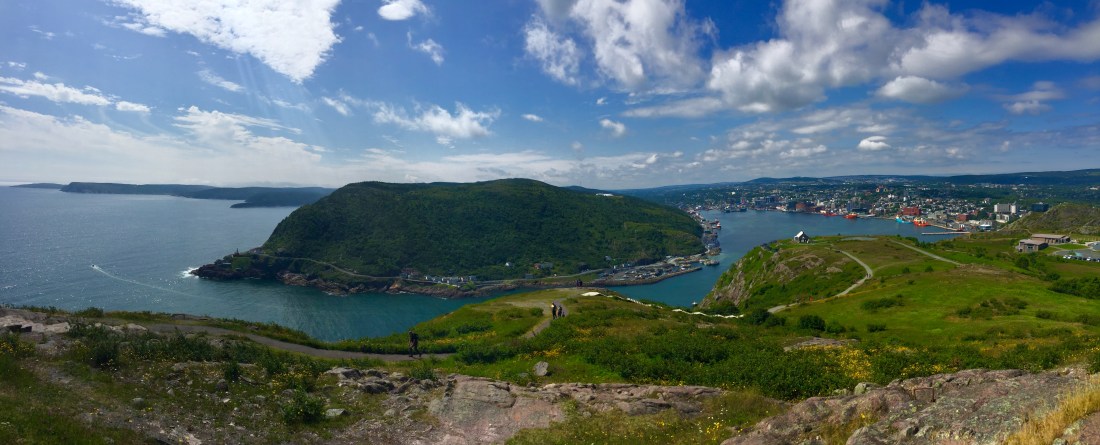
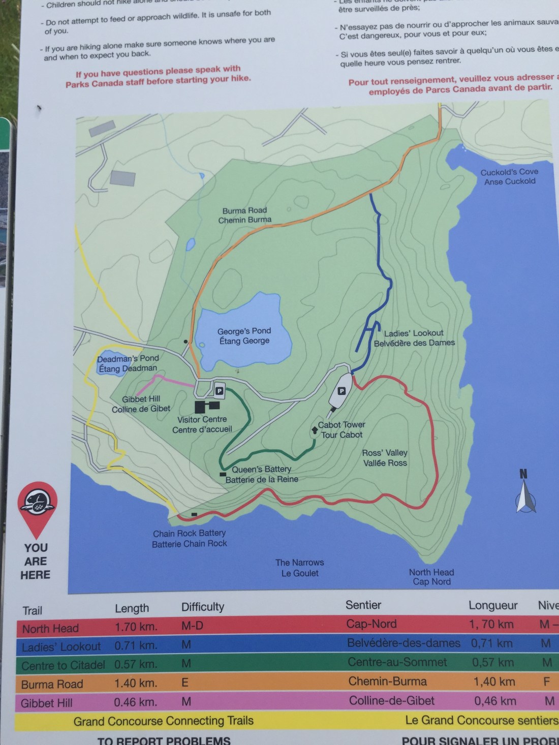
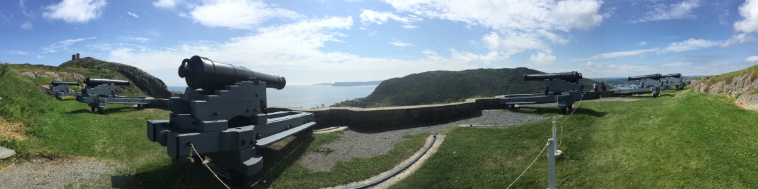
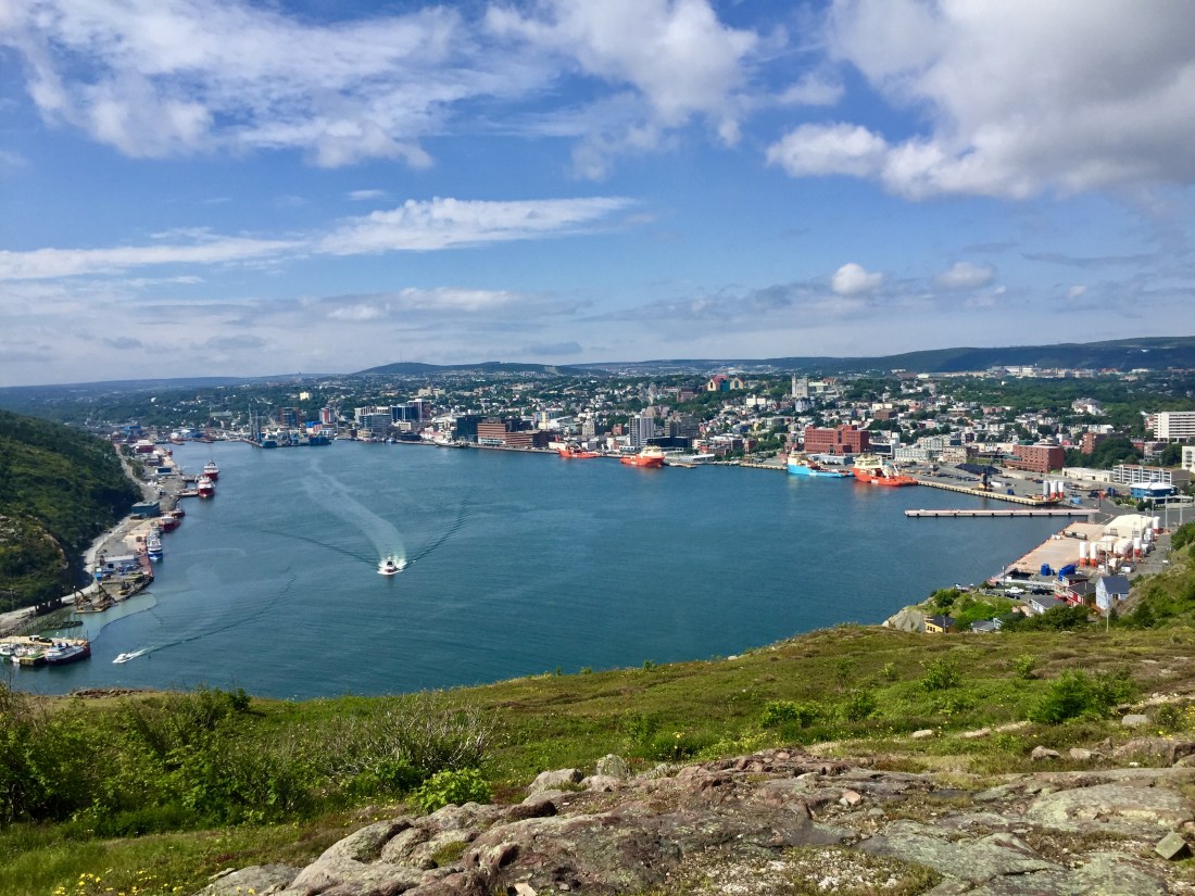
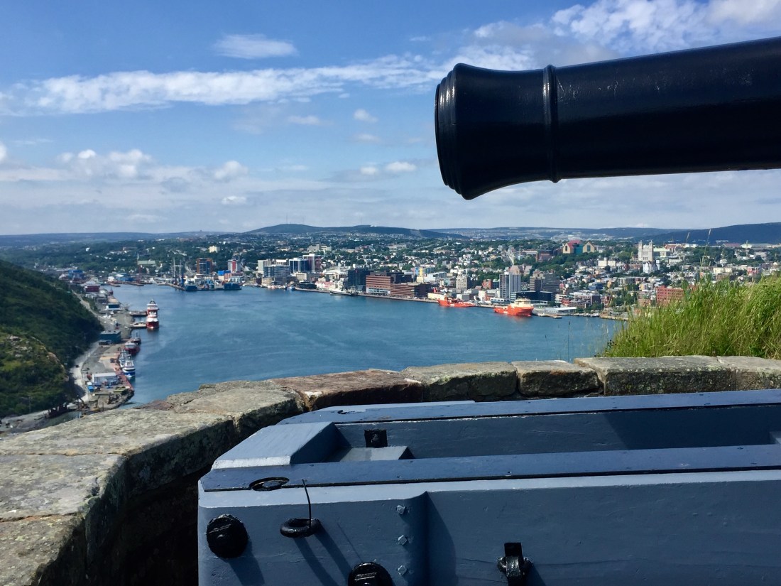
My first sightseeing stop in St. John’s was Signal Hill. Signal Hill sits above the mouth of the harbor and is easily visible from the downtown area. The hill was used by the British as part of a signalling system to let those in the downtown area know of friendly or hostile ship activity. At some point the hill became part of the harbor defensive strategy with placement of canons.
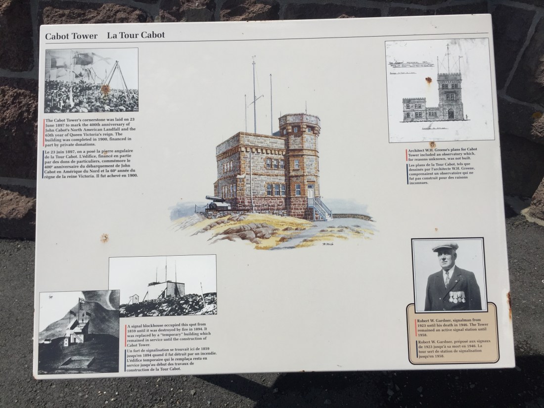
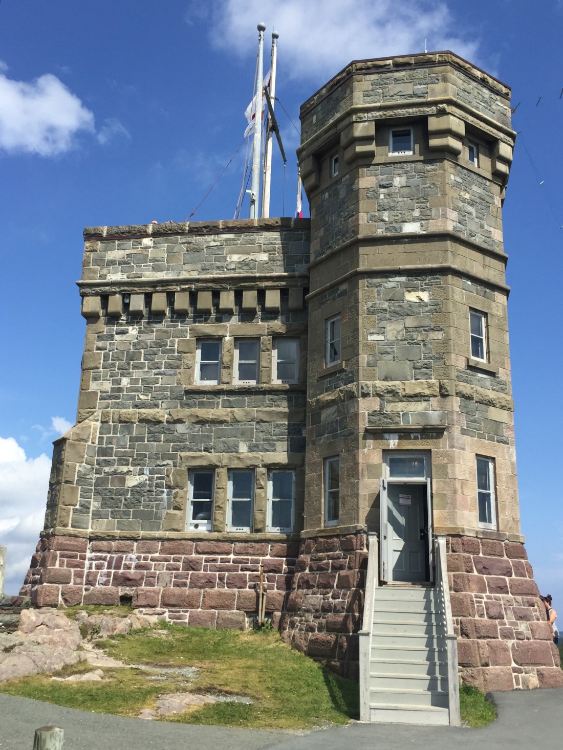
Cabot Tower is also located on Signal Hill. It was built to commemorate the 400th anniversary of John Cabot’s voyage to the new world.
Pics from Signal Hill:
One afternoon, I rode my bicycle from camp and checked out the downtown. Some pics from my bicycle tour are:


Quidi Vidi is a picturesque fishing village that was absorbed as St. John’s expanded. The Quidi Vidi Brewing Company sits on the water in the village and is worth a stop for food and a brew.


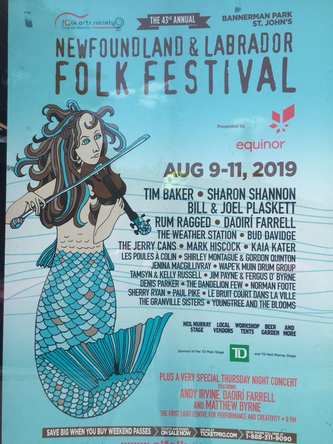
The Newfoundland and Labrador Folk festival took place at Bannerman Park in St. John’s. The park was located around 2 miles from my camp. I road my bicycle down during the first day to scout things out. I would then walk to the park for the music which began late afternoon and went just past midnight.. Two days of good music and a good time.


As I was walking back to camp (around mid-night) after the music ended, I met a local couple walking the same way. They both were professors at the local university. We talked about that night’s music, the university and St. John’s.
They asked where I was staying and they told me that their house was on the way back toward camp. They mentioned they knew short cuts through the neighborhoods. As we were walking on a dark alley between houses, the lady looked at me and said “didn’t your mom ever tell to not walk down dark alley’s with strangers”. We had a good laugh on that.
When we reached their house they offered to drive me the rest of the way back to camp. I noted the walk would do me good. Our conversations continued on for quite awhile before I started toward camp. This is just one example of the friendliness, humor and kindness of the Newfoundlander’s. I experienced many such “touches” during my time in Newfoundland.
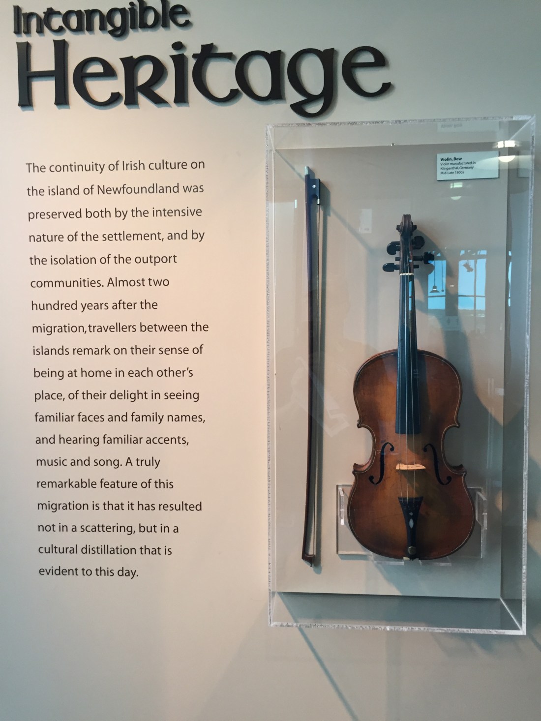
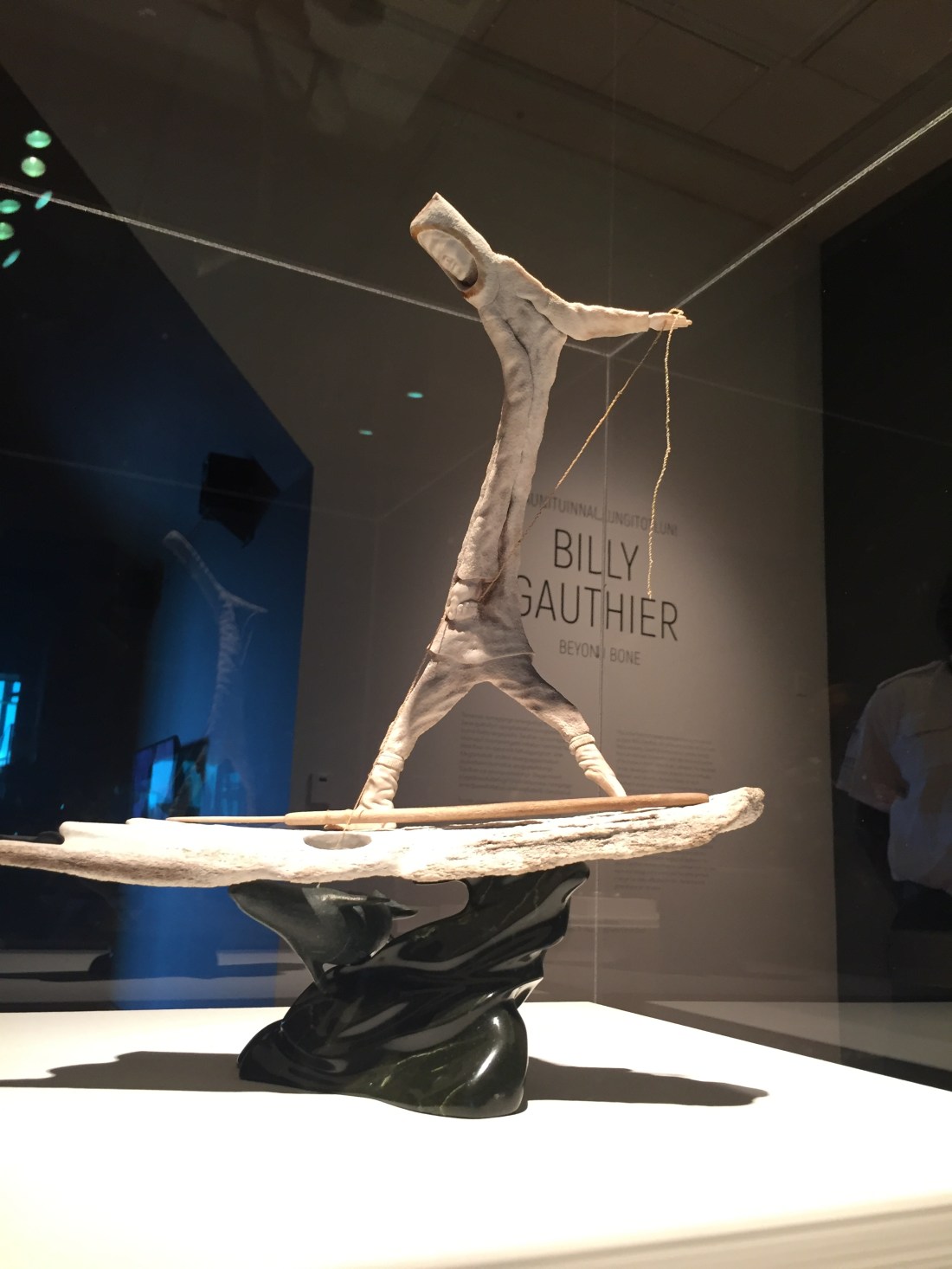
When I asked locals for recommendations, The Rooms was always mentioned. The Rooms combines a provincial museum, art gallery, and archives under one roof. It is well worth the visit. The restaurant has great food.
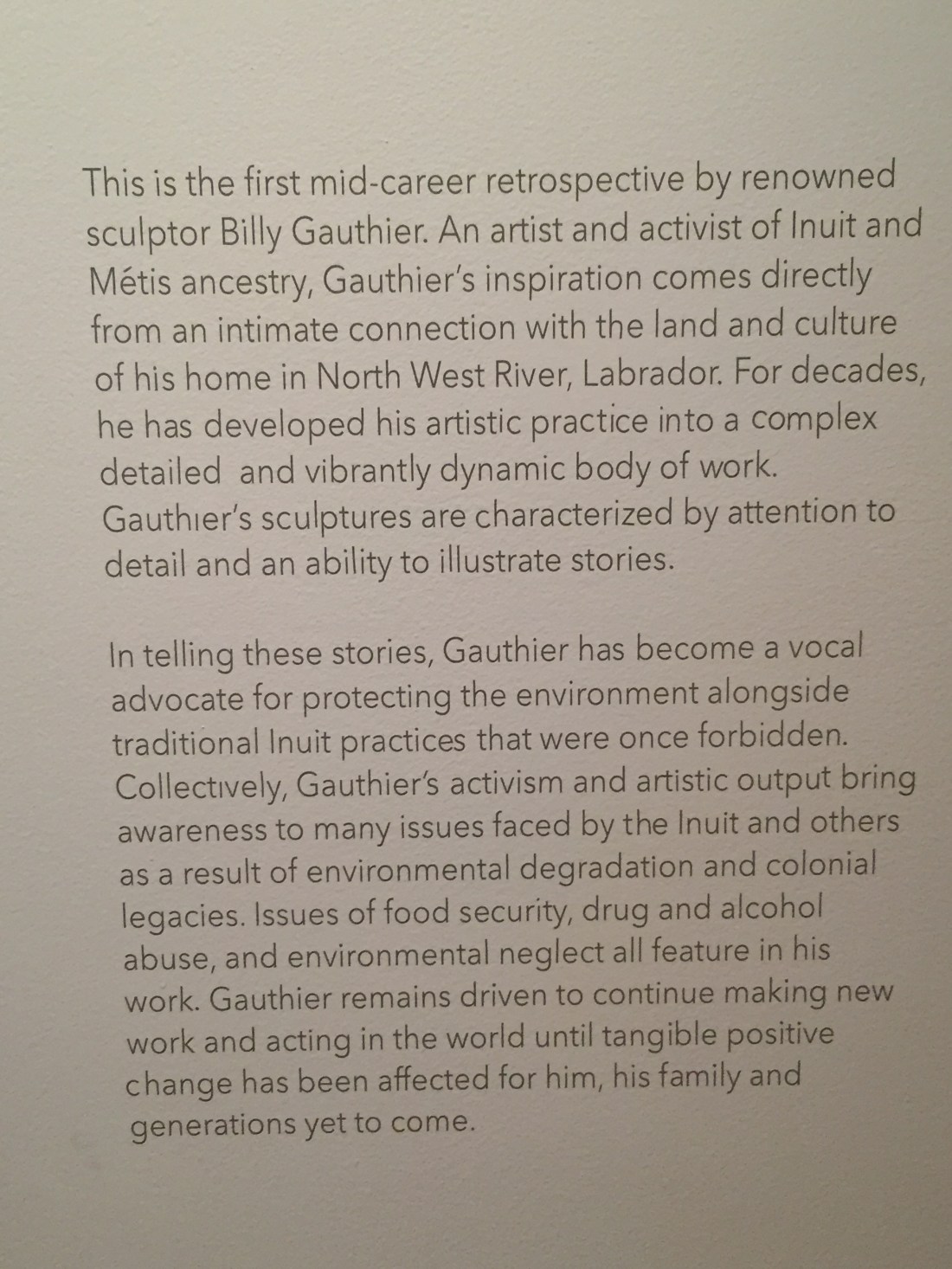
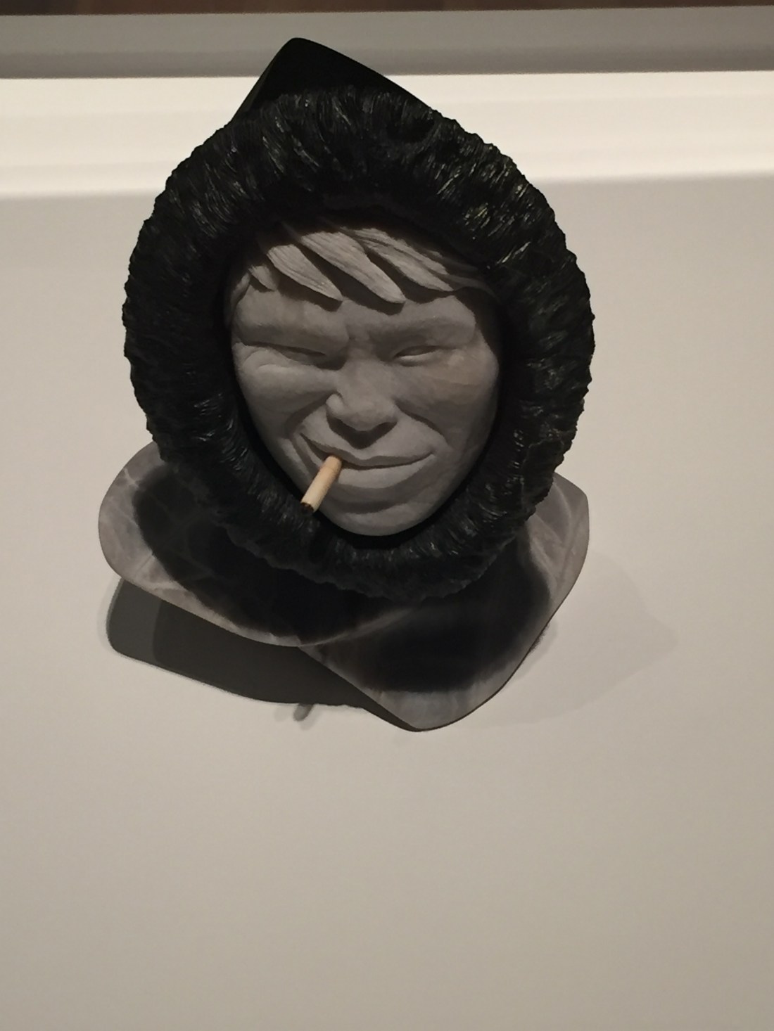
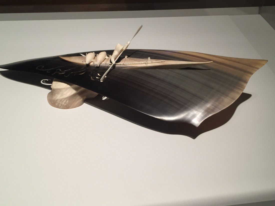
The Billy Gauthier special exhibit was spectacular.


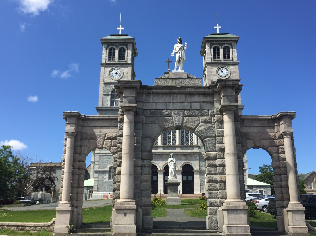
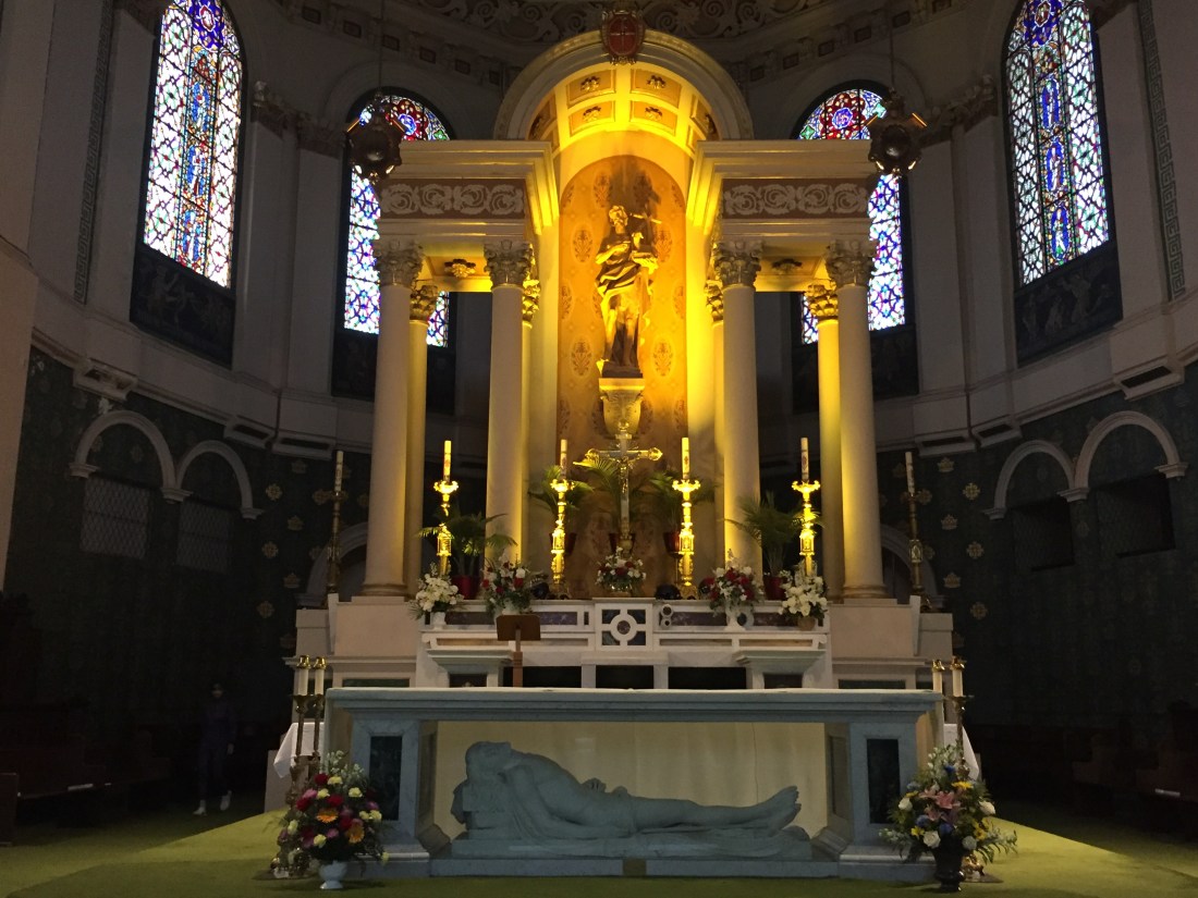
The Basilica Cathedral of St. John the Baptist is located a block from The Rooms. The Rooms and the Cathedral sit of a hill above the downtown and are visible from many points across St. John’s.
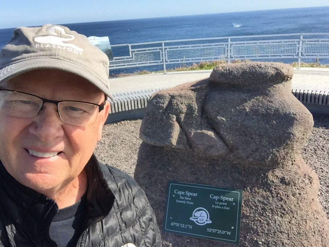
Cape Spear is North America’s most easterly point. It offers scenic views looking back toward the mouth of St. John’s Bay, hiking trails and a very cool lighthouse.
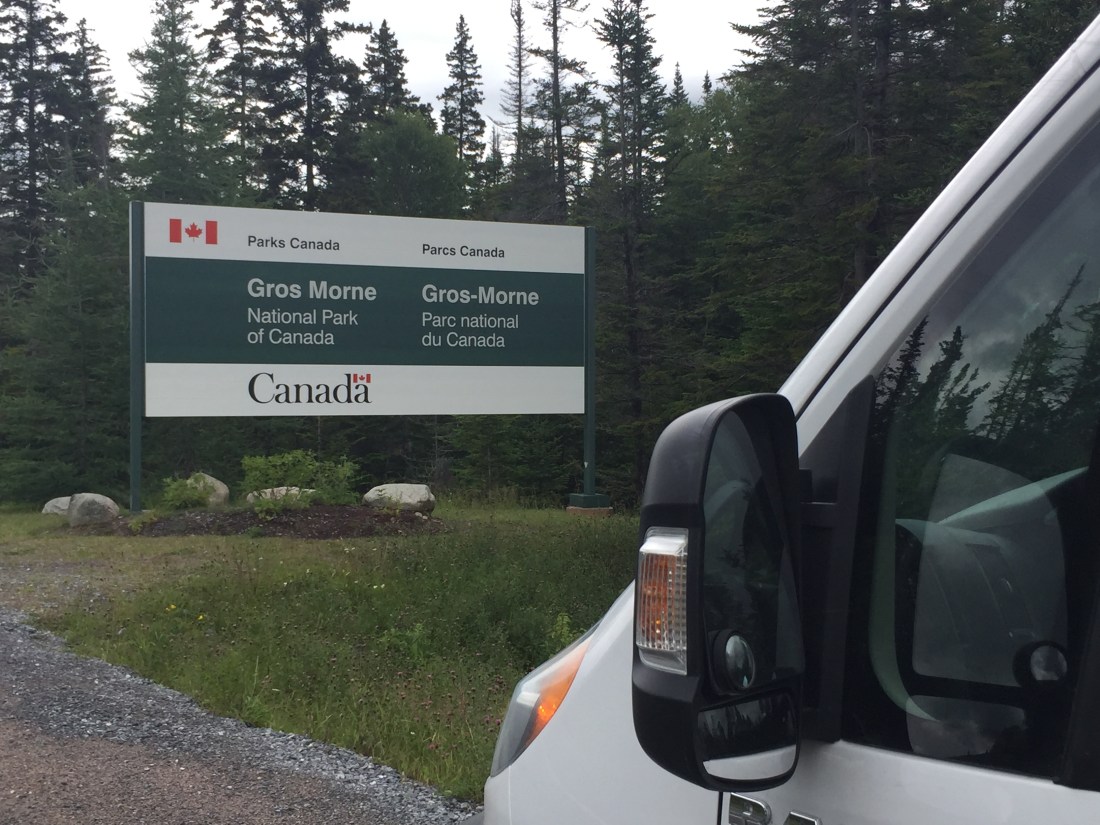
Gros Morne National Park
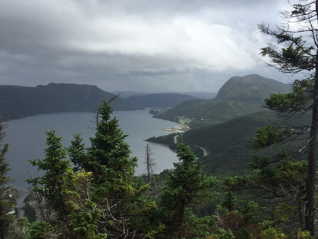
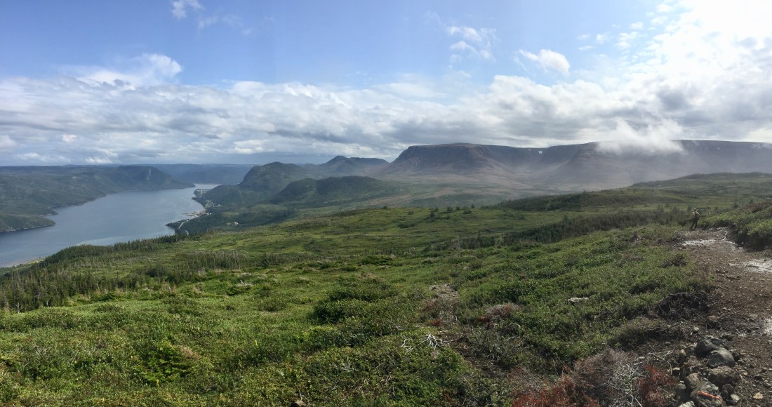
Gros Morne National Park is located in the Northwest section of Newfoundland and fronts the Gulf of St. Lawrence. The park is a UNESCO World Heritage Site. If you ever get the chance, “just go”. One road (Route 430) travels the length of the park with the Gulf waters on one side and the Long Range Mountains on the other.
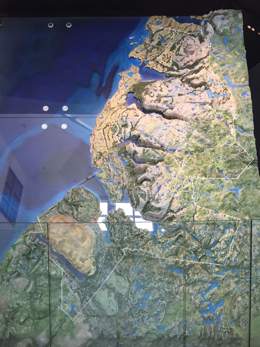
The earths crust is made up of a number of plates that move and often collide with each other. Areas where collisions take place offer an array of geologic insight. Gros Morne is such an area and is a geological wonderland.
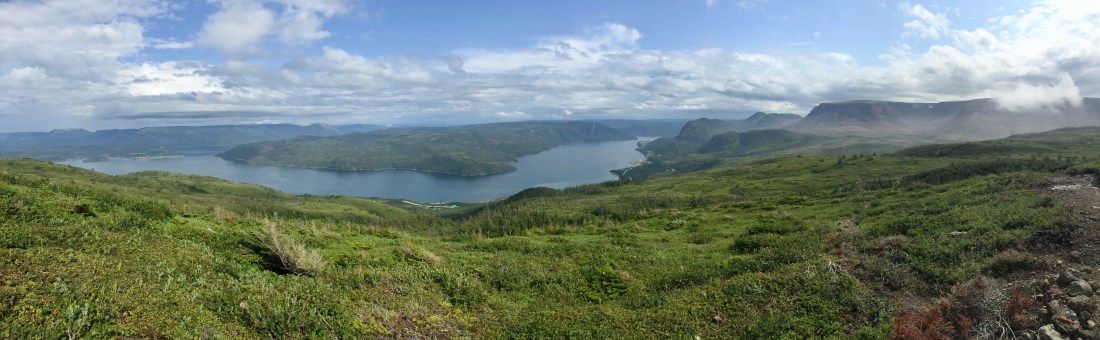
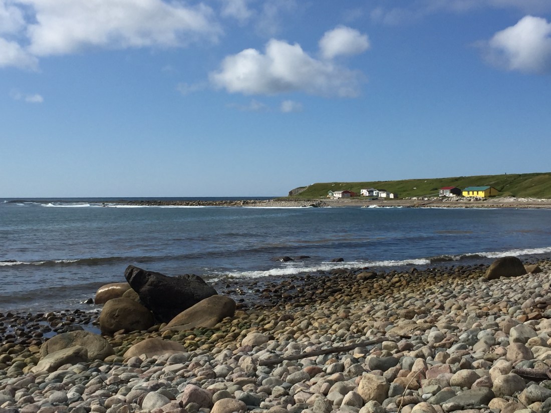
The following 3D-Map, shows the park’s layout. The light brown area in the bottom left is the Tablelands (more on that later). Above the Tablelands, is a bay area which has a number of small towns / fishing villages which cater to visitors. Above the bay area are a number of “fingers” cut into the land as glaciers cut paths from the mountains to the sea. These fingers create fjords, both salt and fresh water. You can see examples (in the picture below) of the fresh water fjords where the fingers no longer reach the sea. Fresh water fjords are unusual.
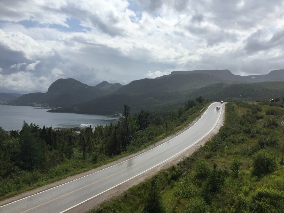
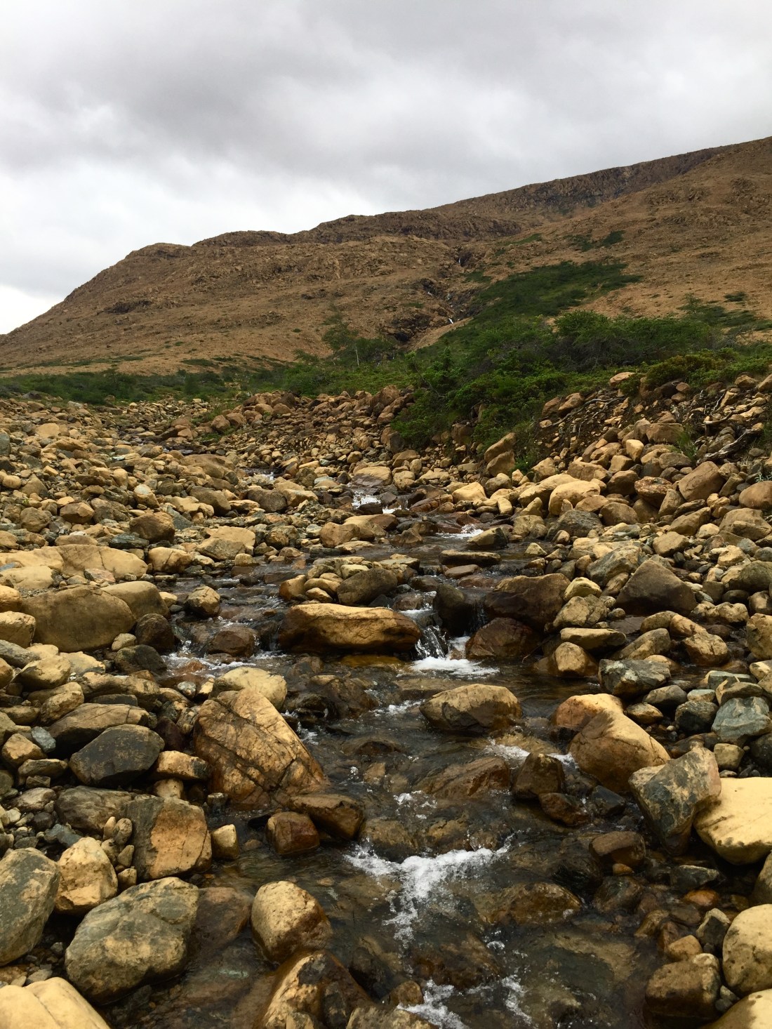
The following picture shows the road leading to the Tablelands, which are visible in the upper right.
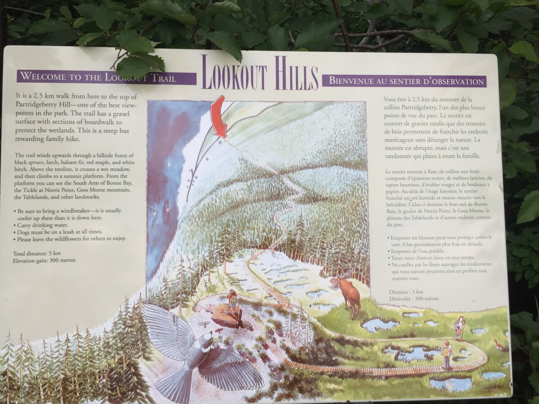
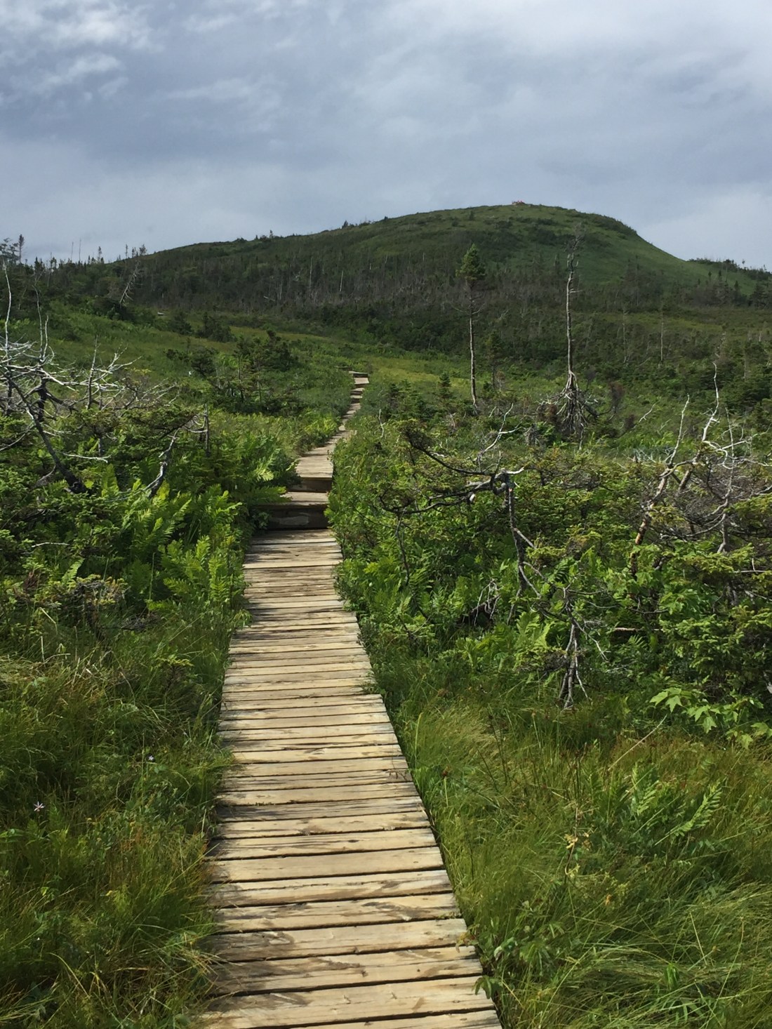
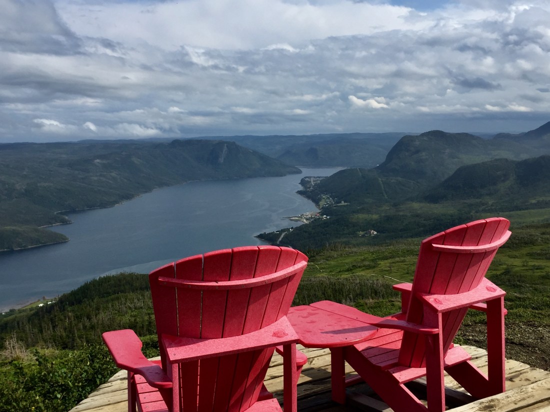
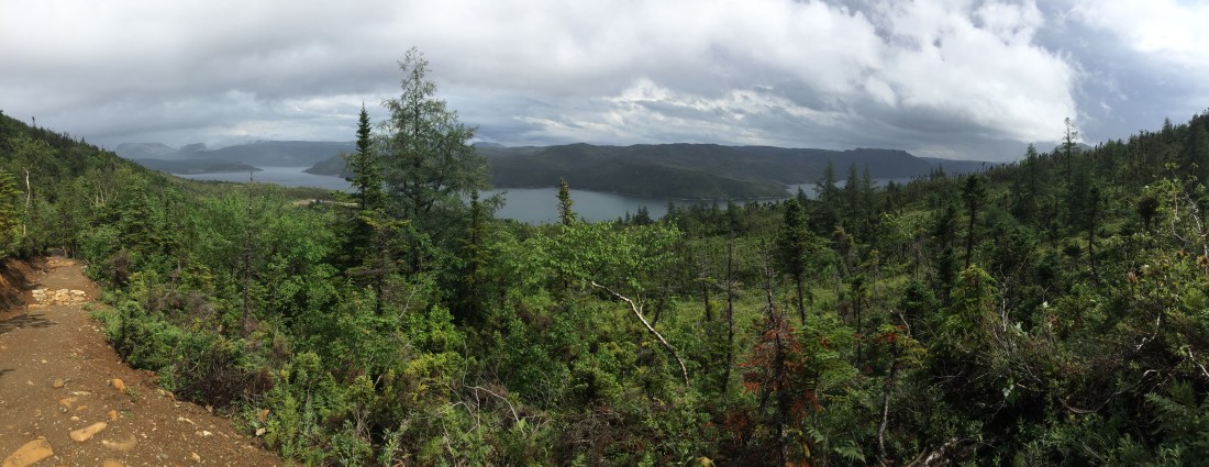
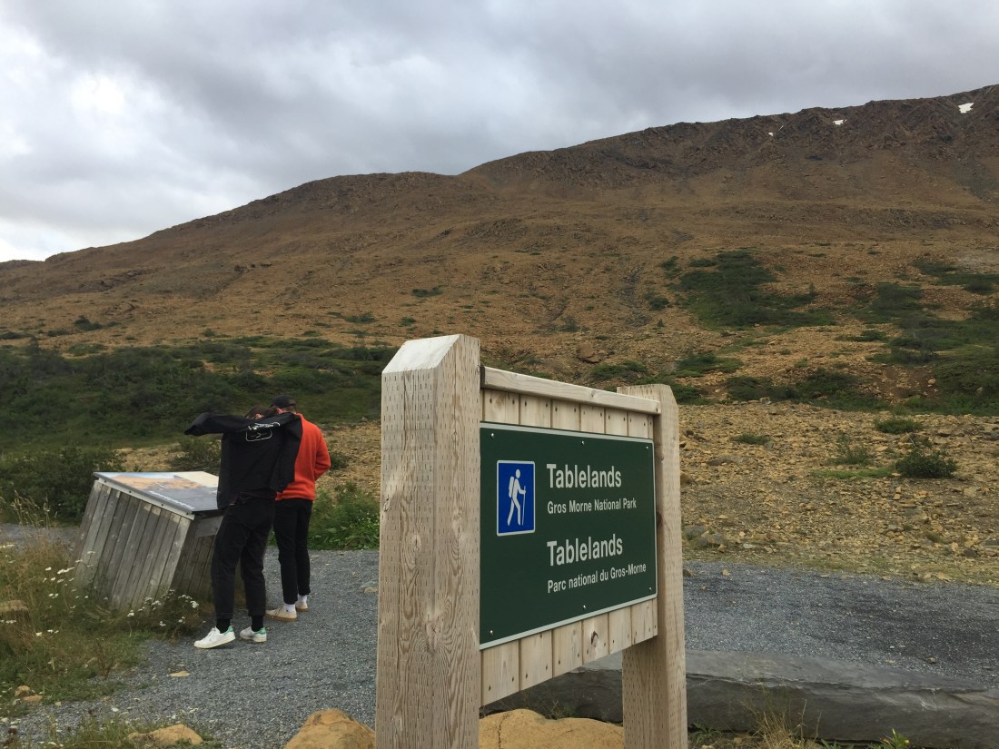
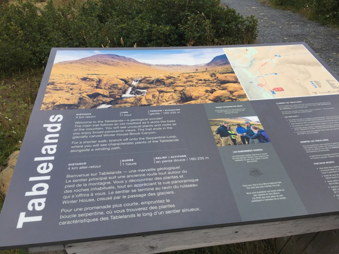
Before reaching the Tablelands, there is a Discovery Center which is worth a stop. From the Discovery Center parking lot is the start of the Lookout trail. Pretty cool trail with great views at the top.
The Tablelands is the parks most prized geological wonder, as rock from the earth’s mantel is exposed. The rock does not contain nutrients needed by plants which provides for a barren landscape.
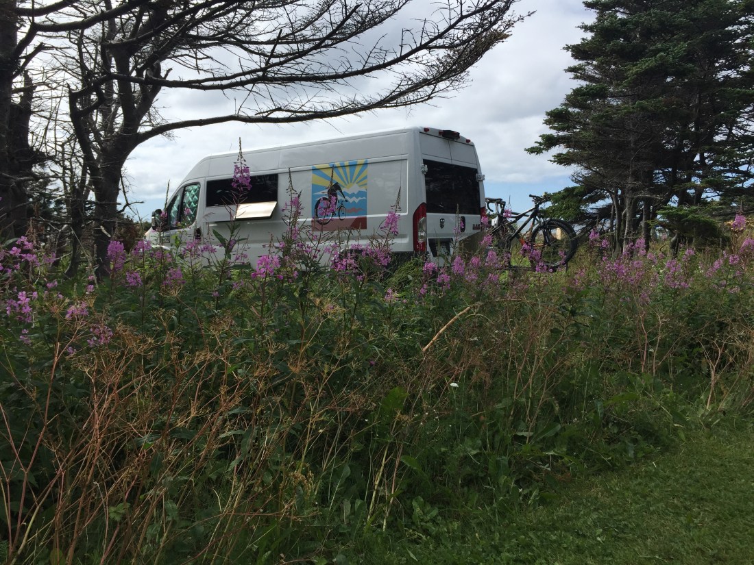
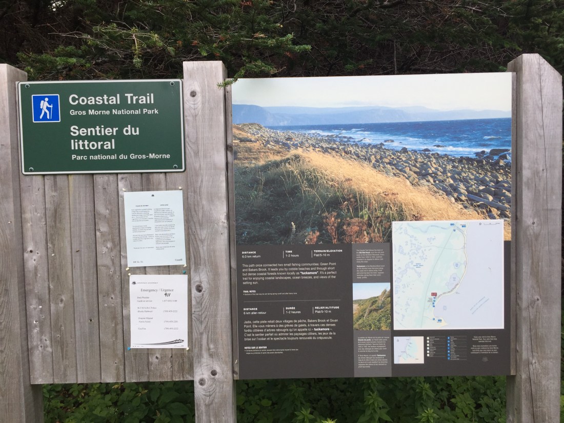
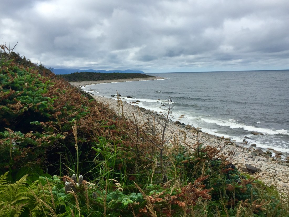
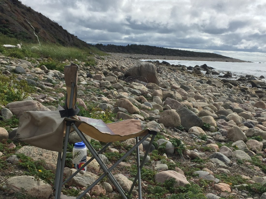
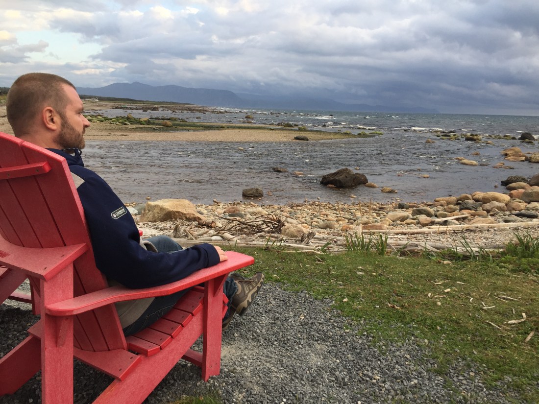
For all but one night, I camped at Green Point Campground which is located right on the coastal shore. One end of the coastal trail starts at the campground. I enjoyed hiking the trail and also used its vantage points for beach access and sunset viewing.
A picture of my campsite:
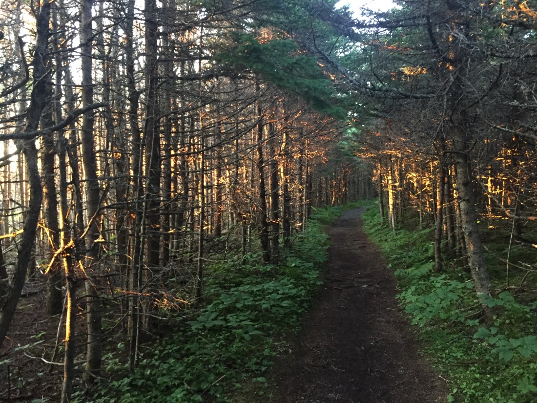
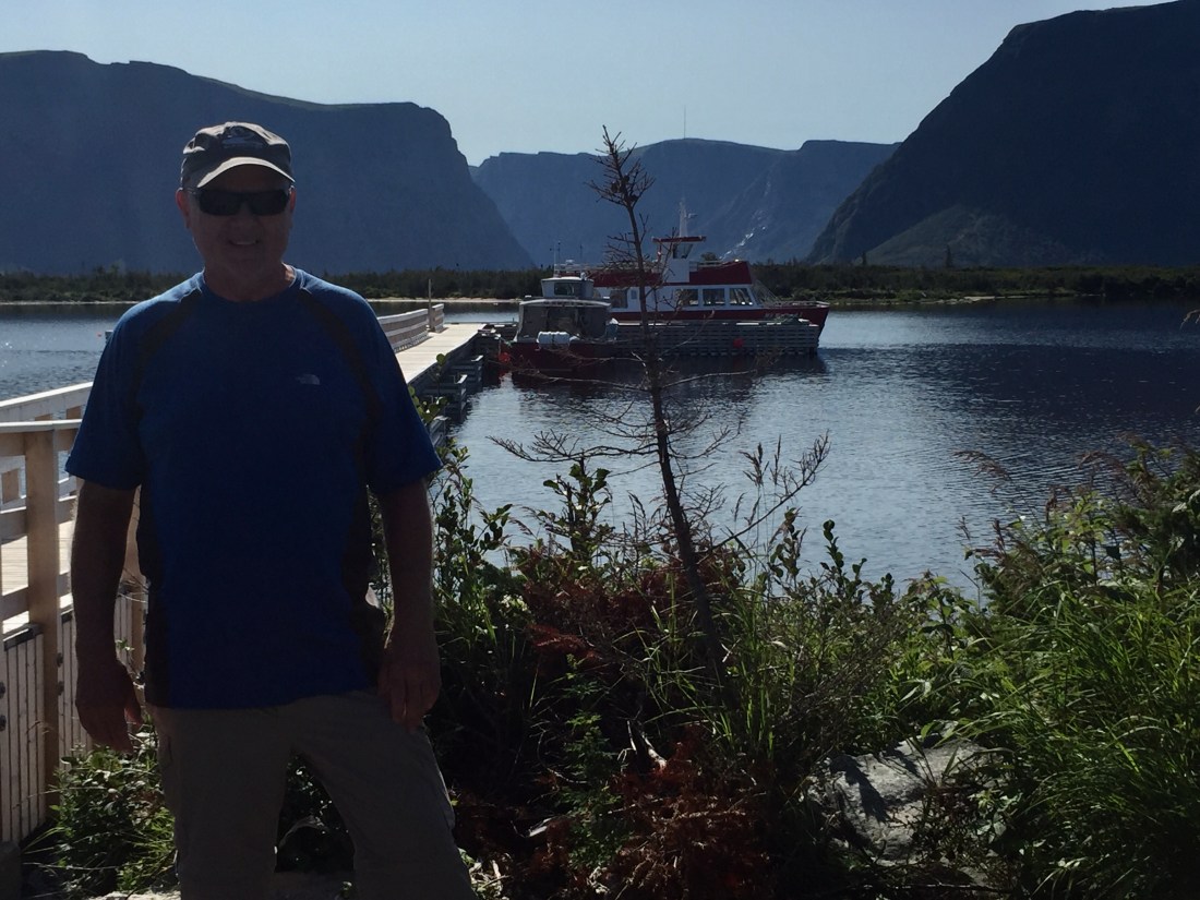
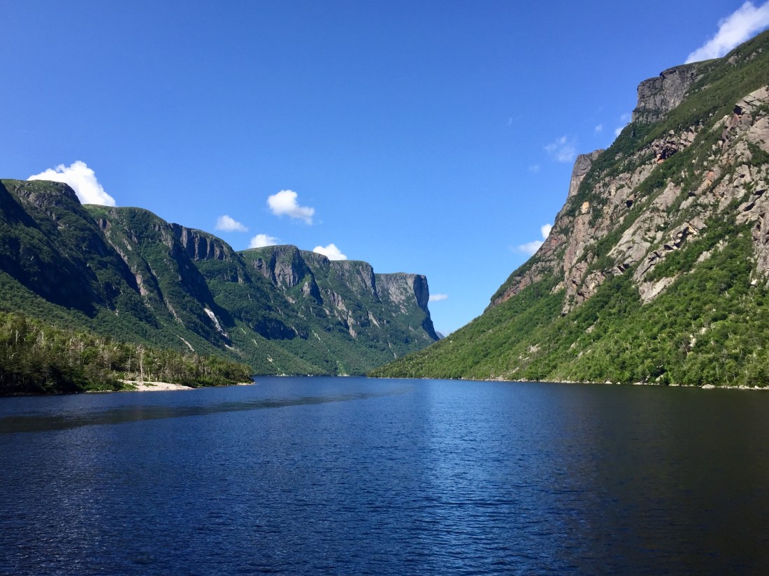
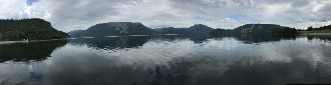
Western Brook Pond is one of the fresh water fjords within the park. A two hour boat tour is available. The tour offers stunning views of cliffs and waterfalls. The start of the boat tour is reached via a 2 mile trail from the parking lot near the highway. I highly recommend the tour.
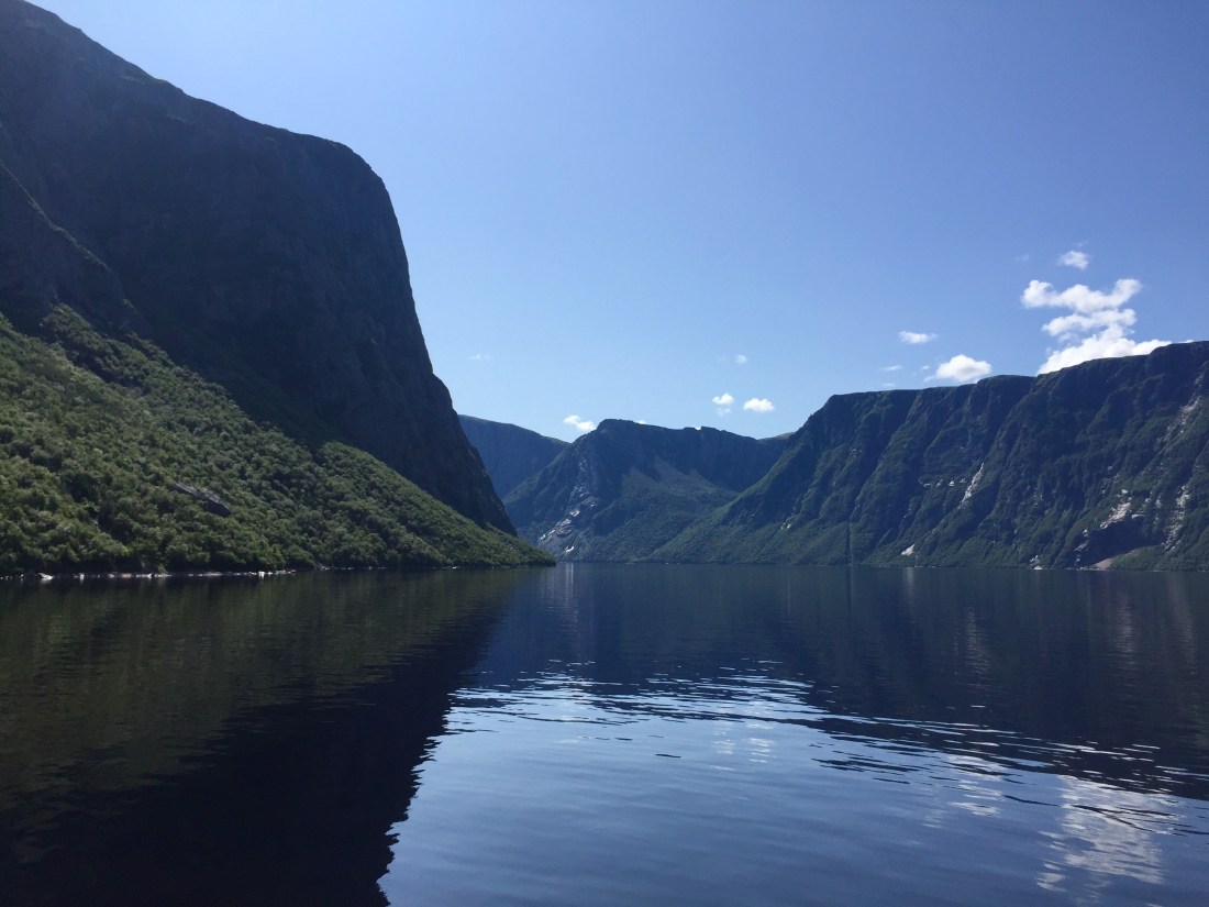
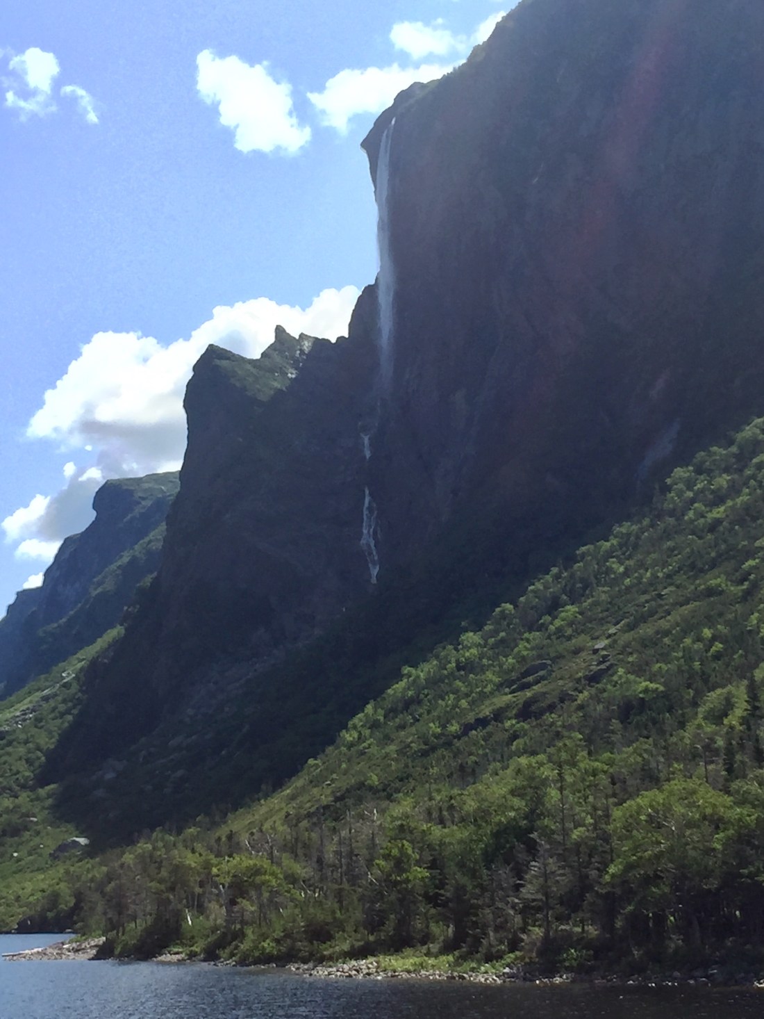
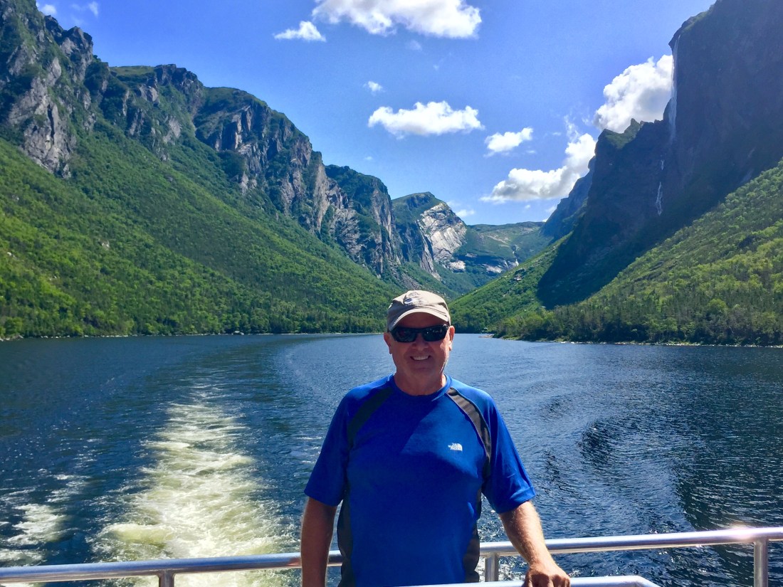
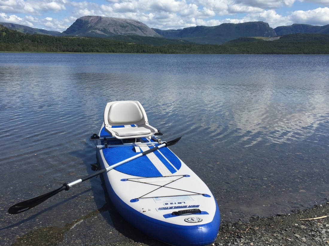
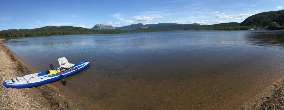
I really enjoyed some “my time” on the water, so scenic and relaxing:
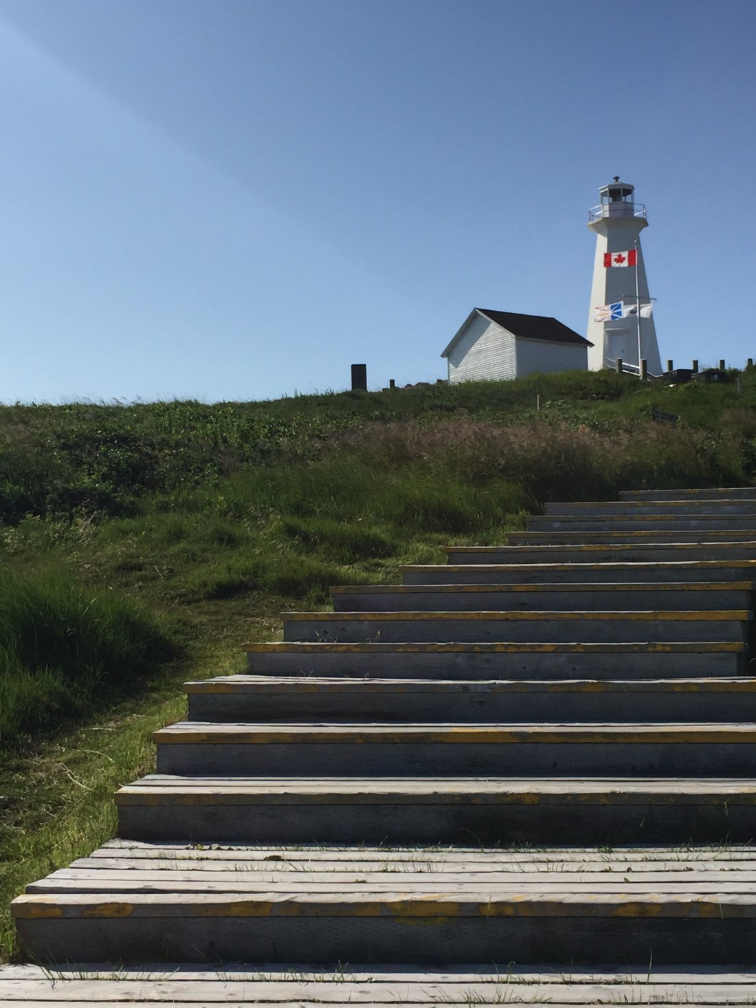
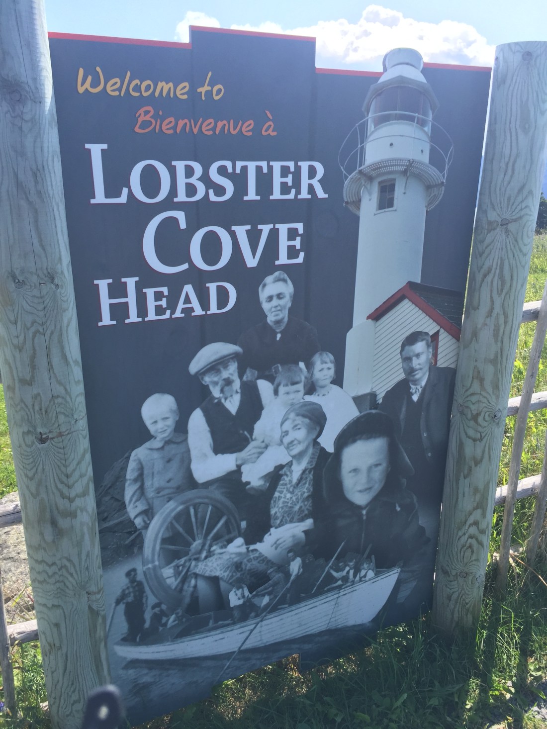
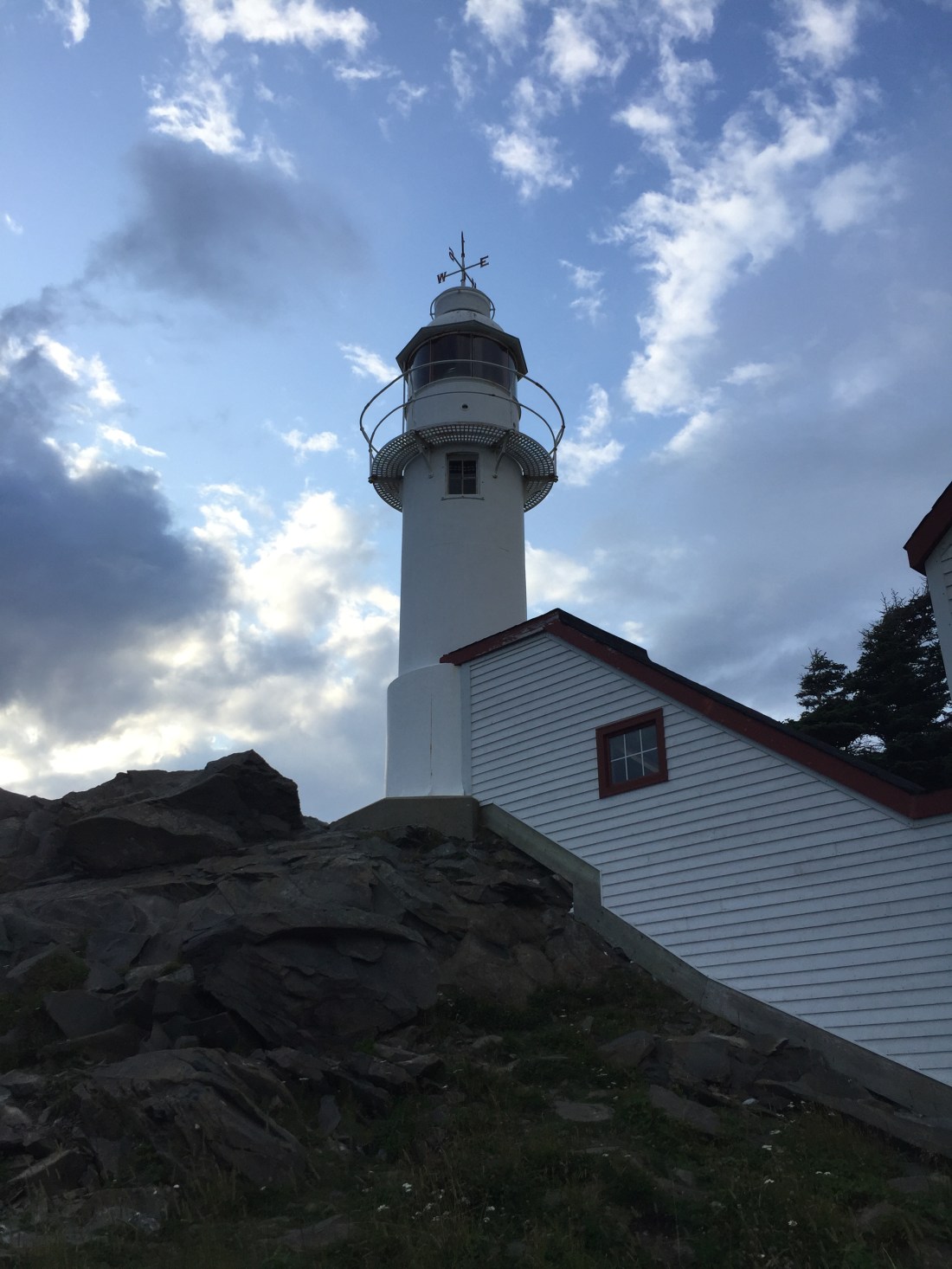
Lobster Cove Head has a lighthouse with exhibits and ocean views:
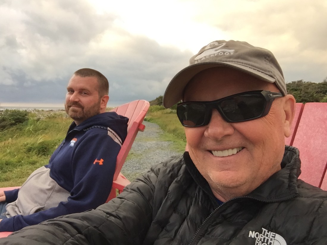
My son flew into Newfoundland from the US to join me, primarily for a drive through Labrador. I picked him up at Deer Lake and we were able to enjoy the park together for a day / night before heading to Labrador. We camped at the Shallow Bay campground which sits closer to St. Barbe where we caught the ferry to Labrador.
Next stop, Labrador.
