New Brunswick, Canada

IMG_1832

After an eventful trip through the US, I made it to Canada.  I have always wanted to travel through the Canadian Maritime Provinces and now I am here.  My travels will take me through 7 Canadian Provinces, 8 Canadian National Parks and a slew of Provincial Parks.

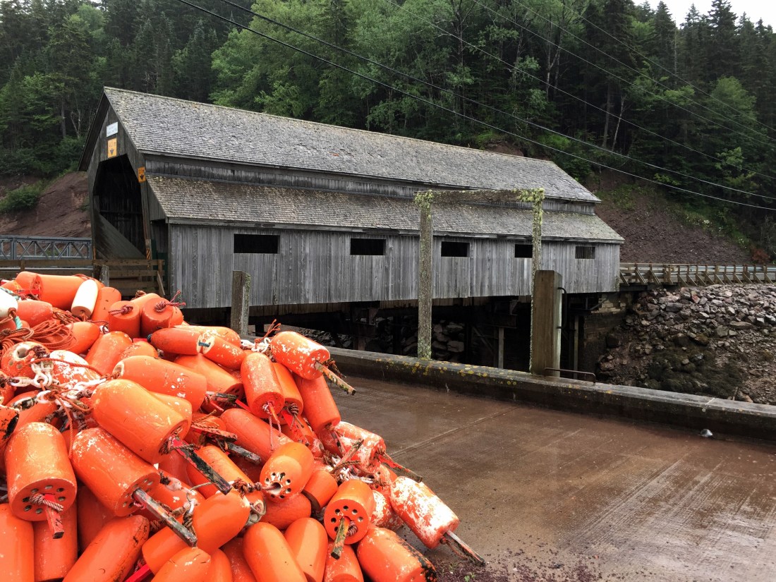
In New Brunswick (NB), I focused my time on three areas.  These were the Promenade Du Sentier Fundy Trail Parkway, Fundy National Park, and Hopewell Rocks.  The backdrop for all three areas is the Bay of Fundy.

On my way to the Fundy Trail Parkway,  I stopped in the city of St. John for gas, groceries, and maps / information at the local visitor center.  The city is known for Reversing Falls Rapid, a daily phenomenon created by the collision of the Bay of Fundy tide and the Saint John River. The east side of NB sits against the Bay of Fundy which is know for its tides which rise up to 13 vertical feet per hour and reach heights of up to 46 feet.

While heading to Promenade Du Sentier Fundy Trail Parkway, I saw signs that looked like a light house.  As I am a “sucker” for lighthouses, I followed the signs.  After driving quite a ways and seeing no lighthouse, I stopped at an arts and crafts store (May Moores Specialties).  The store is adjoined to a bed and breakfast.

I talked with May for awhile (many good stories) and she informed me that the lighthouse looking signs indicate scenic drives.  May is quite an artist.  She walked me through her work on display.  Sometimes you meet the most interesting people when just wander.
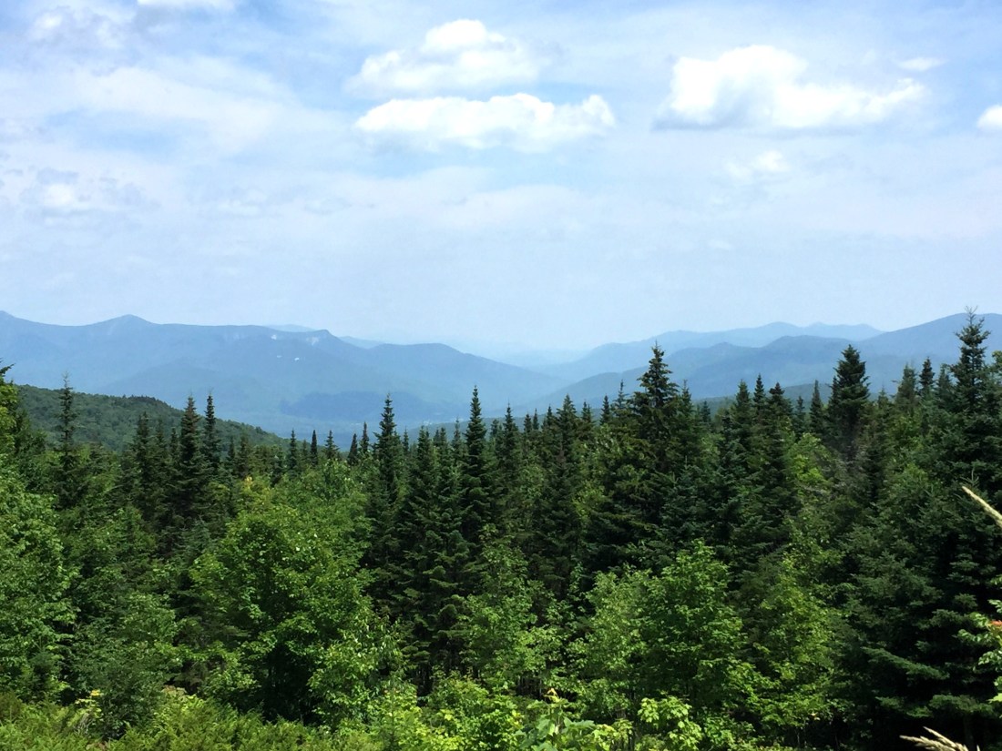
Fundy Trail Parkway

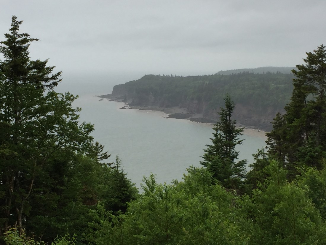
The Parkway is a 38 mile round trip drive with stunning views in every direction.  It is part of two UNESCO designated areas (Stonehammer Global Geopark and the Fundy Biosphere Reserve).  I would recommend spending a full day on the parkway and bringing a picnic lunch.  There was a slight drizzle during my visit but I still really enjoyed the area.

While the route currently dead-ends, there is a plan to extend the road into Fundy National Park.  This will save some driving time for those interested in both the Parkway and the National Park.

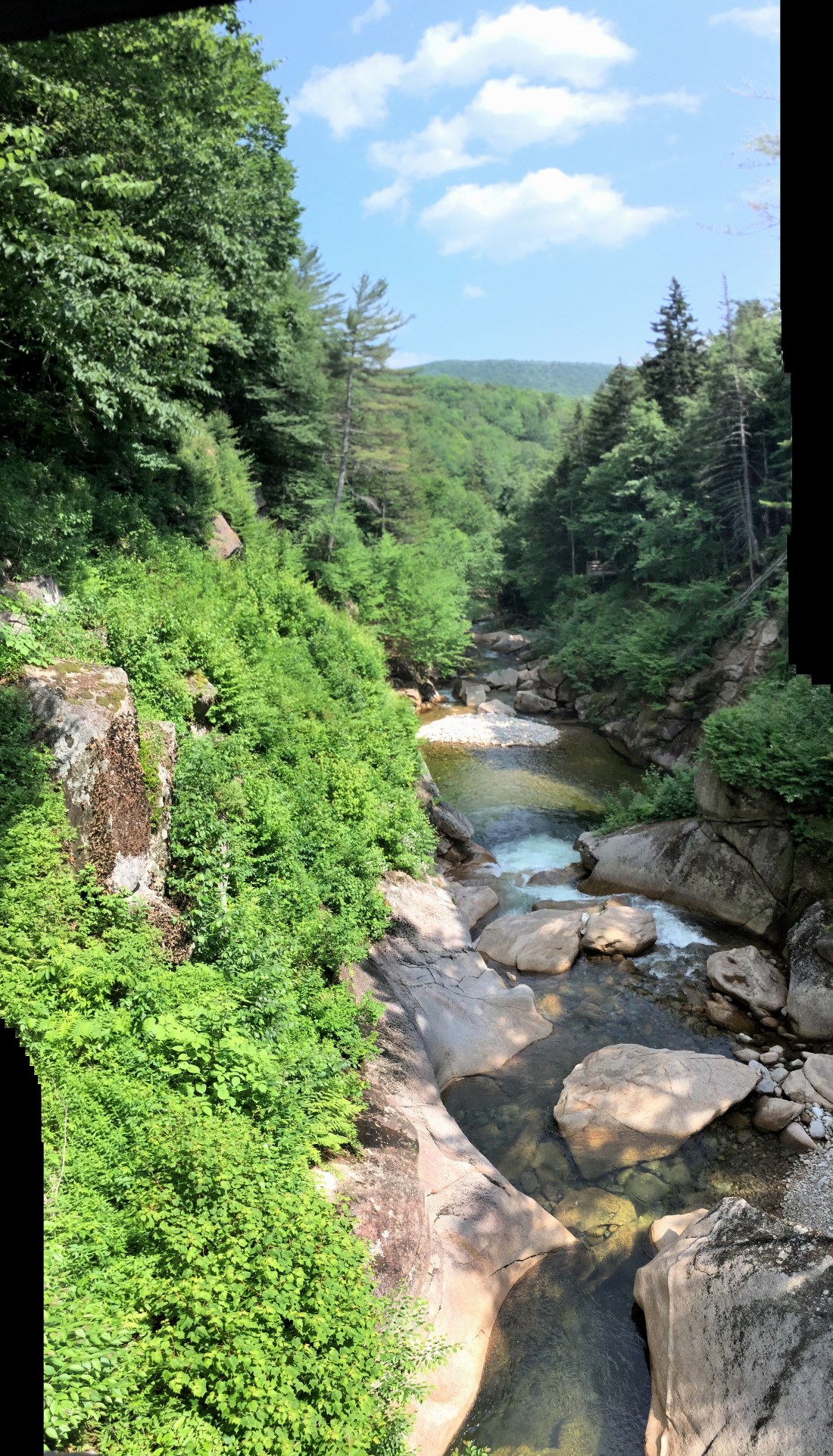
You can seek out pristine beaches, waterfalls, and cliffs with great views.  The sites from the parkway are generally just a short walking distance, providing great rewards with minimal effort.

Some pictures:

IMG_1846IMG_1851IMG_1852IMG_1854IMG_1864IMG_1865IMG_1867

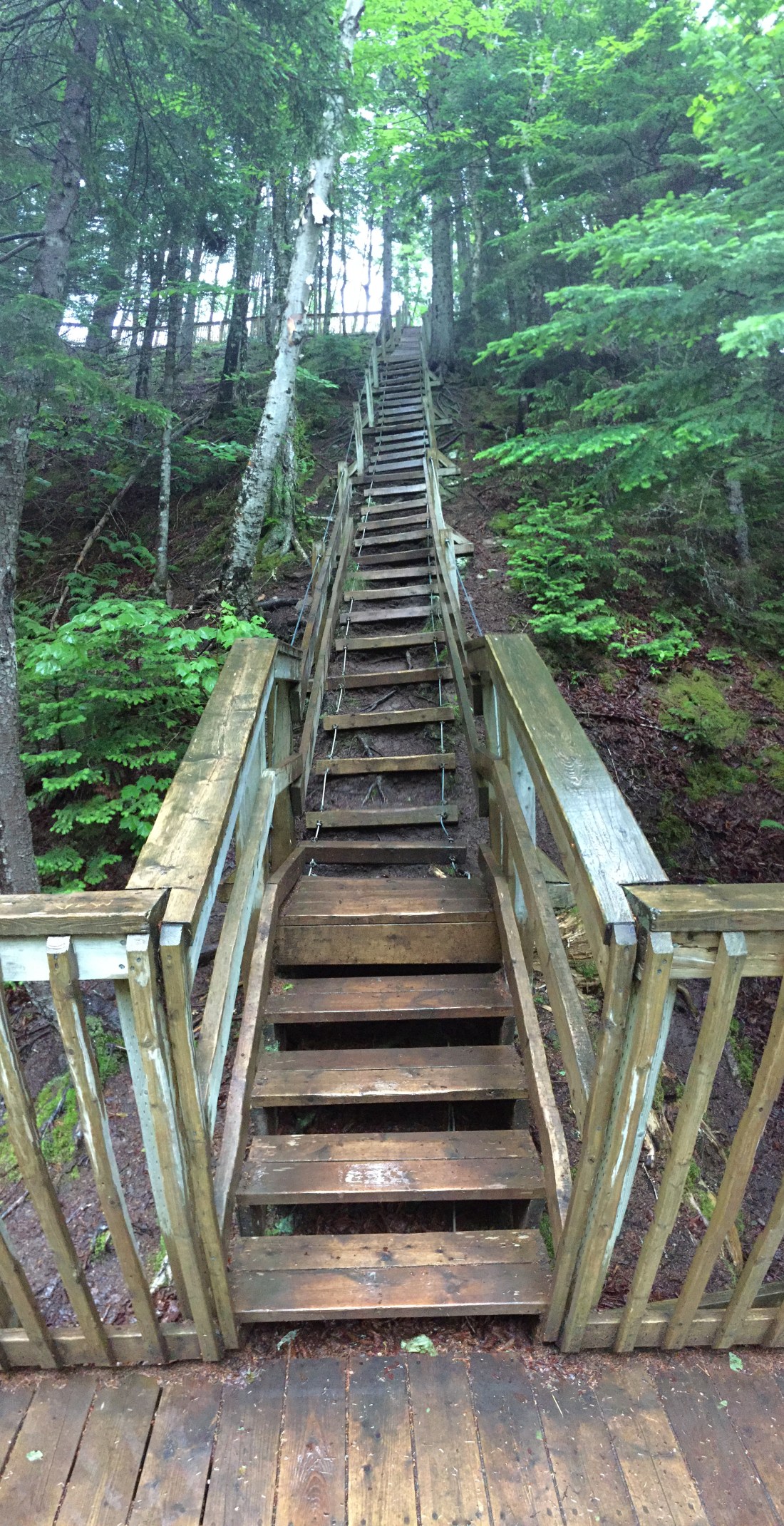
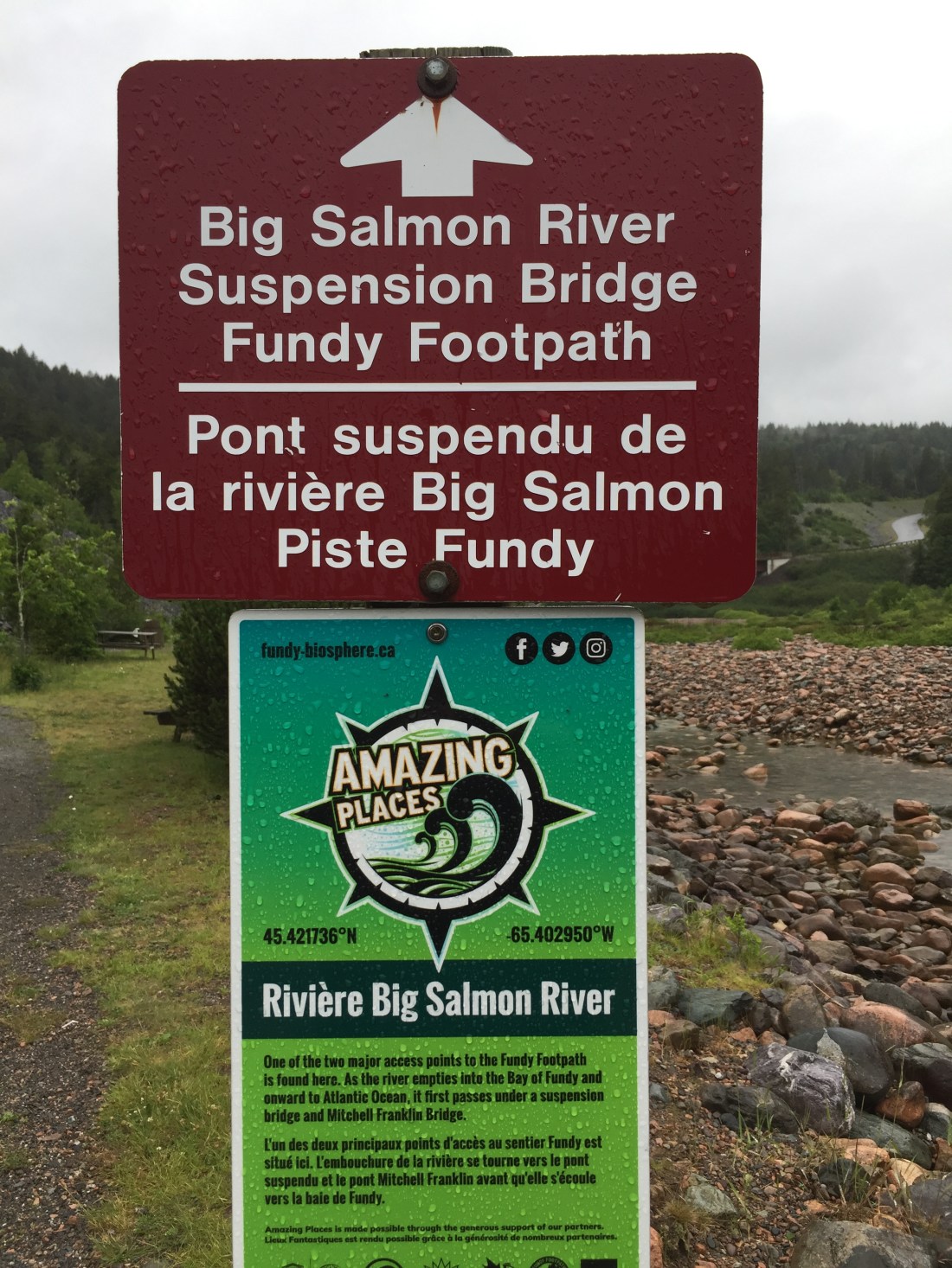
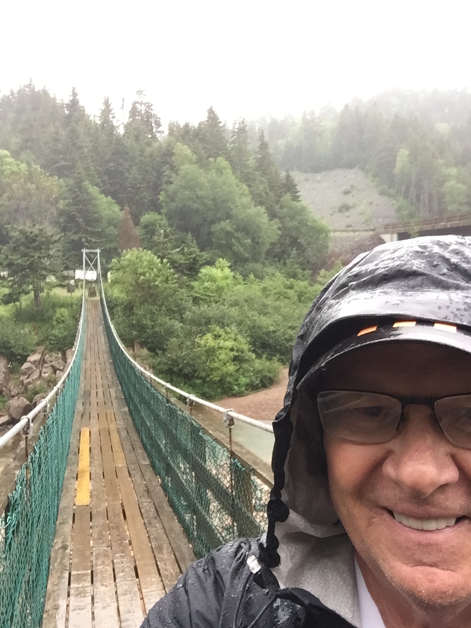
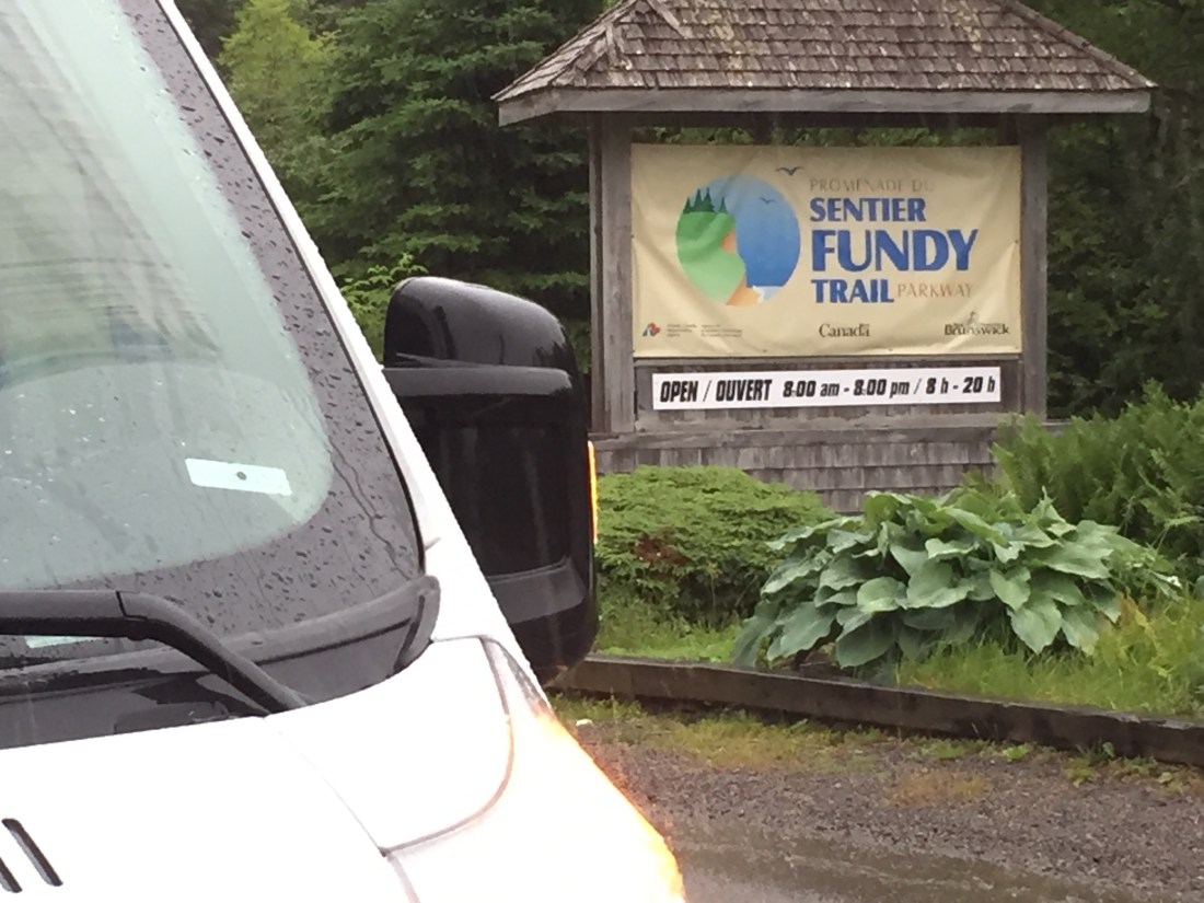
The entrance to the parkway is just outside St. Martins.  The Caves Restaurant has great seafood and is a convenient stop.  From the restaurant, you can also walk out to the Sea Caves (during low tide).

IMG_1869

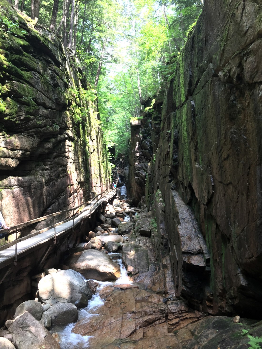
Fundy National Park :

IMG_1872

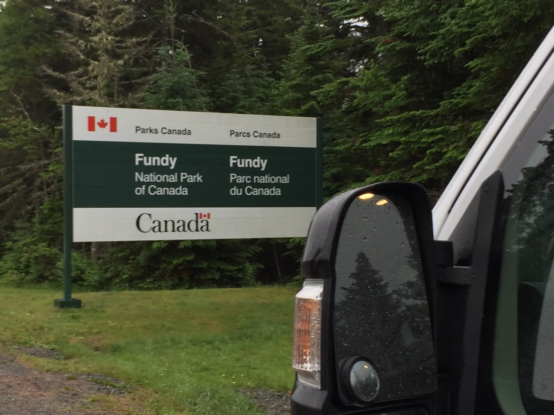
This Park has something for everyone – Mountain Biking, Road Riding, Golfing, Solar Heated Saltwater Pool, Fishing, Paddling, Hiking, and Beaches.

Four campgrounds are located in the park.   In general, each campground centers on different experiences.

  1. Wolfe Lake Campground – lake water activities
  2. Chignecto Campground – mountain biking and hiking activities
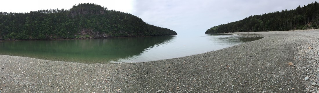
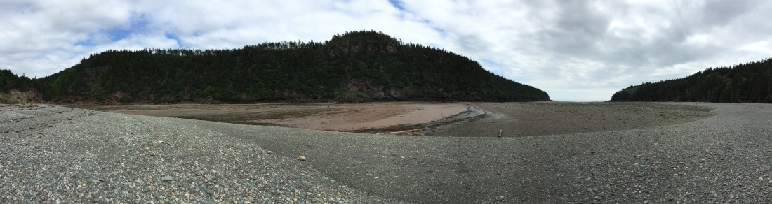
  3. Point Wolfe Campground- Beach (on Bay of Fundy) and coastal hiking activities
  4. Headquarters Campground – Golf, Pool, Family activities

I camped for three days at Point Wolfe Campground.  I spent my time hiking, hanging at the beach, mountain biking, road cycling, and sitting around the campfire.

Some pics from the park:
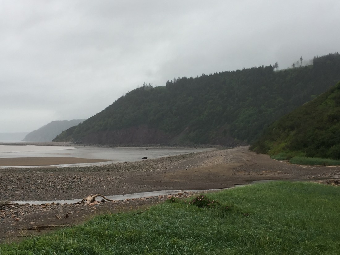
High Tide versus Low Tide

IMG_1876IMG_1899

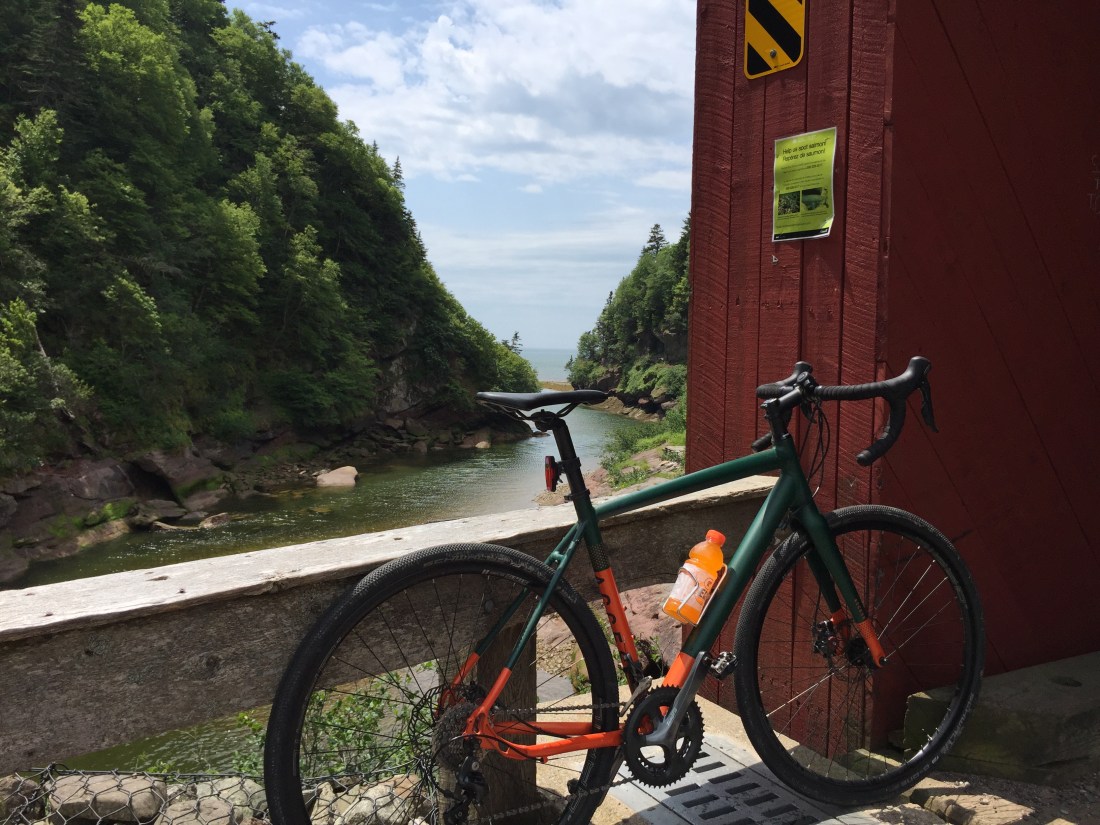
Mountain Biking on Goose River Trail – So much fun, smile from ear to ear.  The trail is on the cliffs overlooking the Bay.

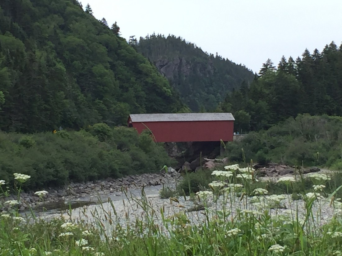
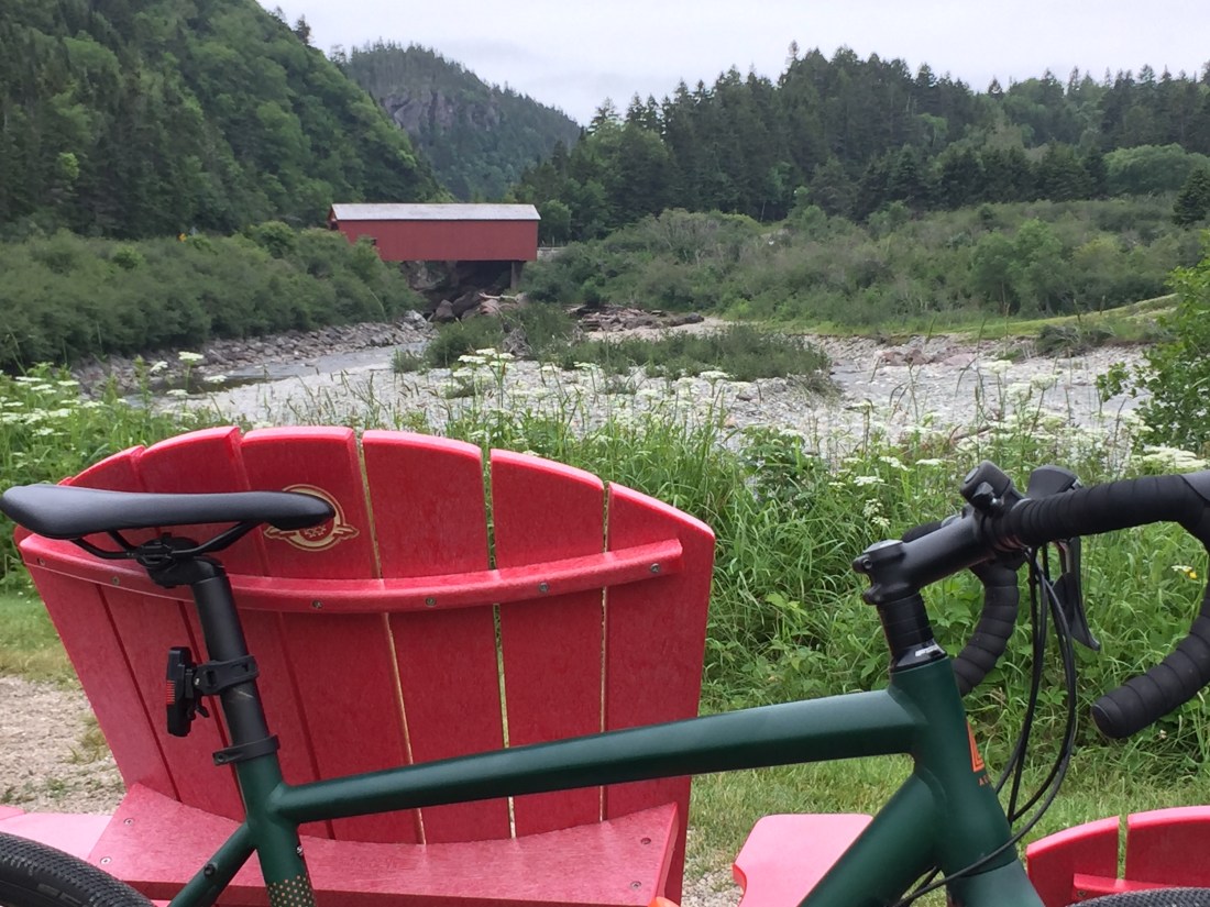
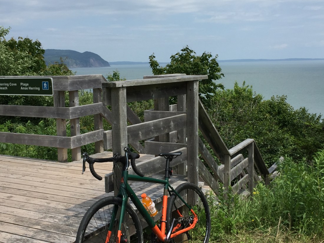
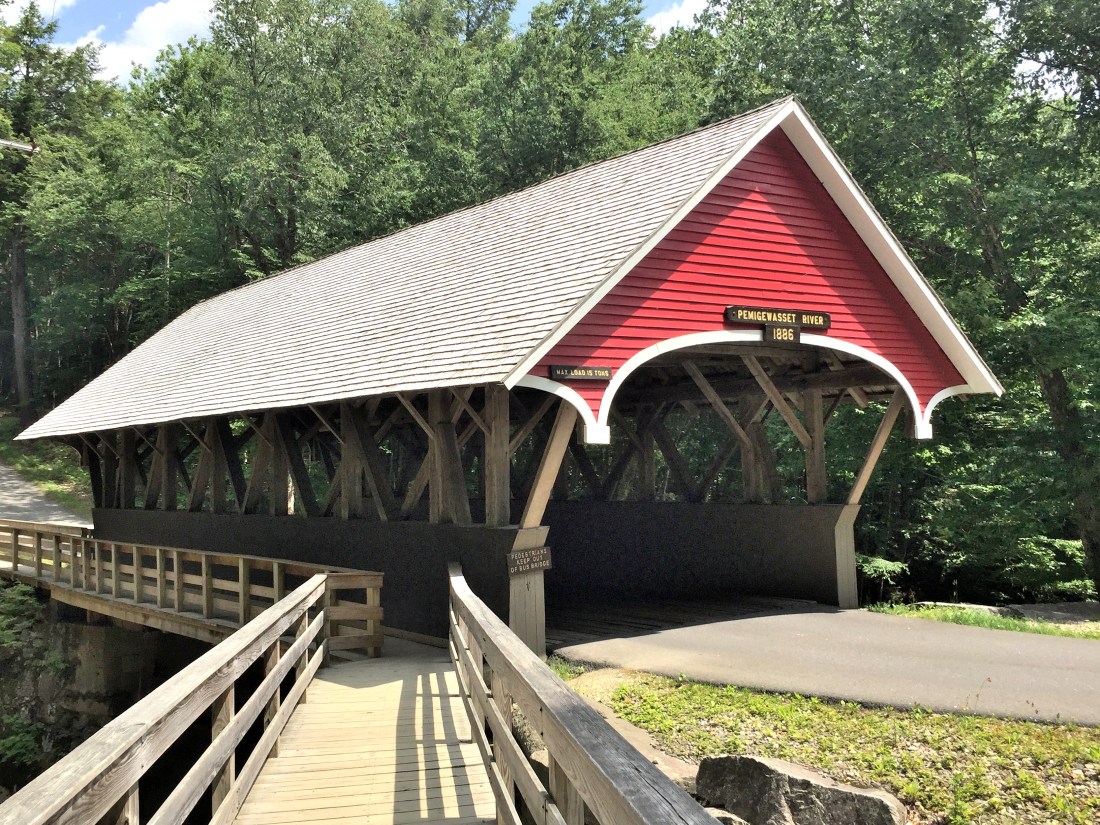
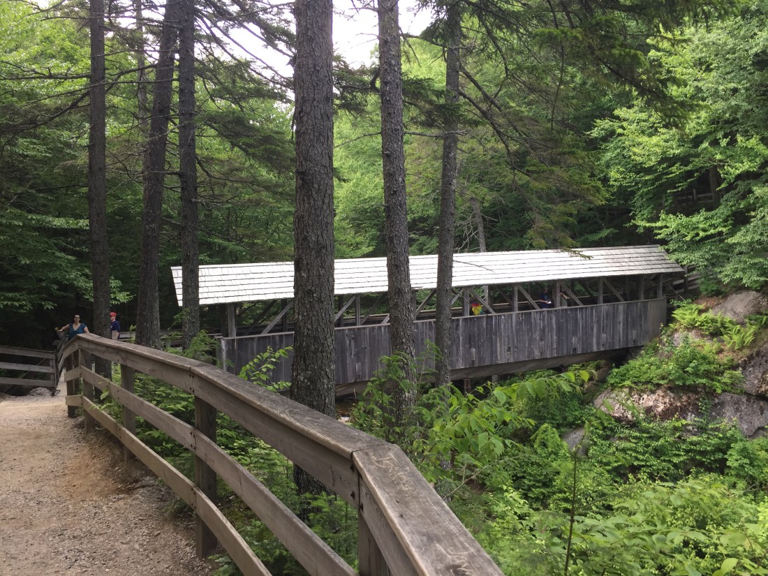
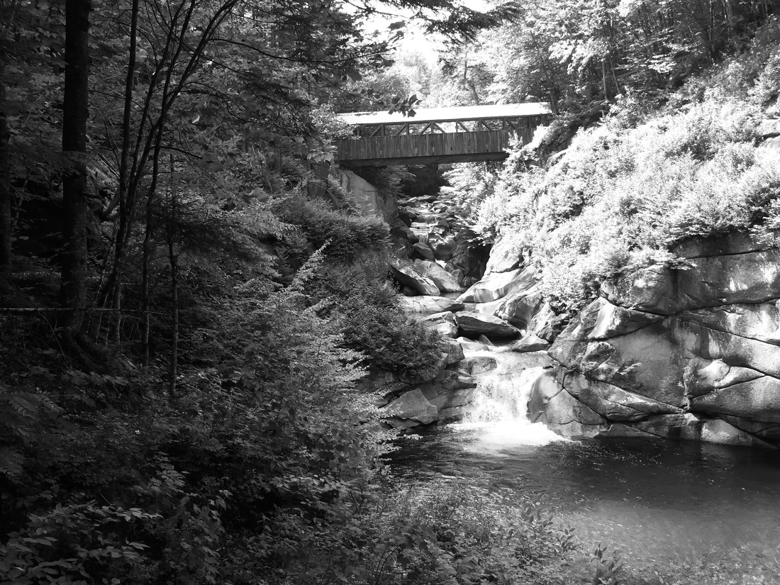
Road Ride From Campground to Herring Cove Beach:  The road crosses over a covered bridge with scenic views.  The National Parks in Canada places two red Adirondack chairs in scenic areas for visitors to sit and enjoy.
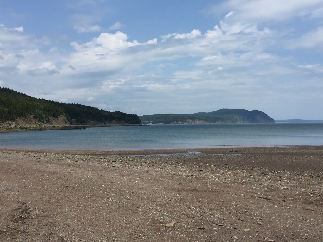
IMG_1921IMG_1907IMG_1908IMG_1925

Herring Cove Beach:

IMG_1909IMG_1911

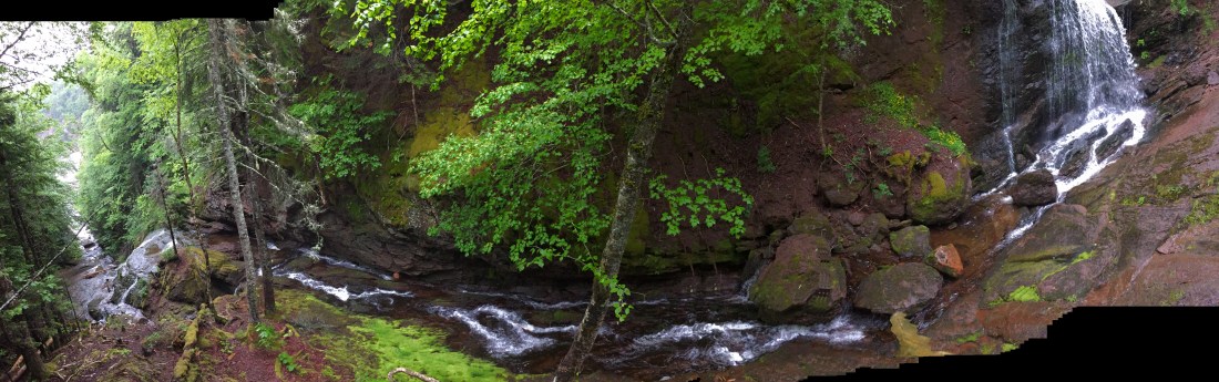
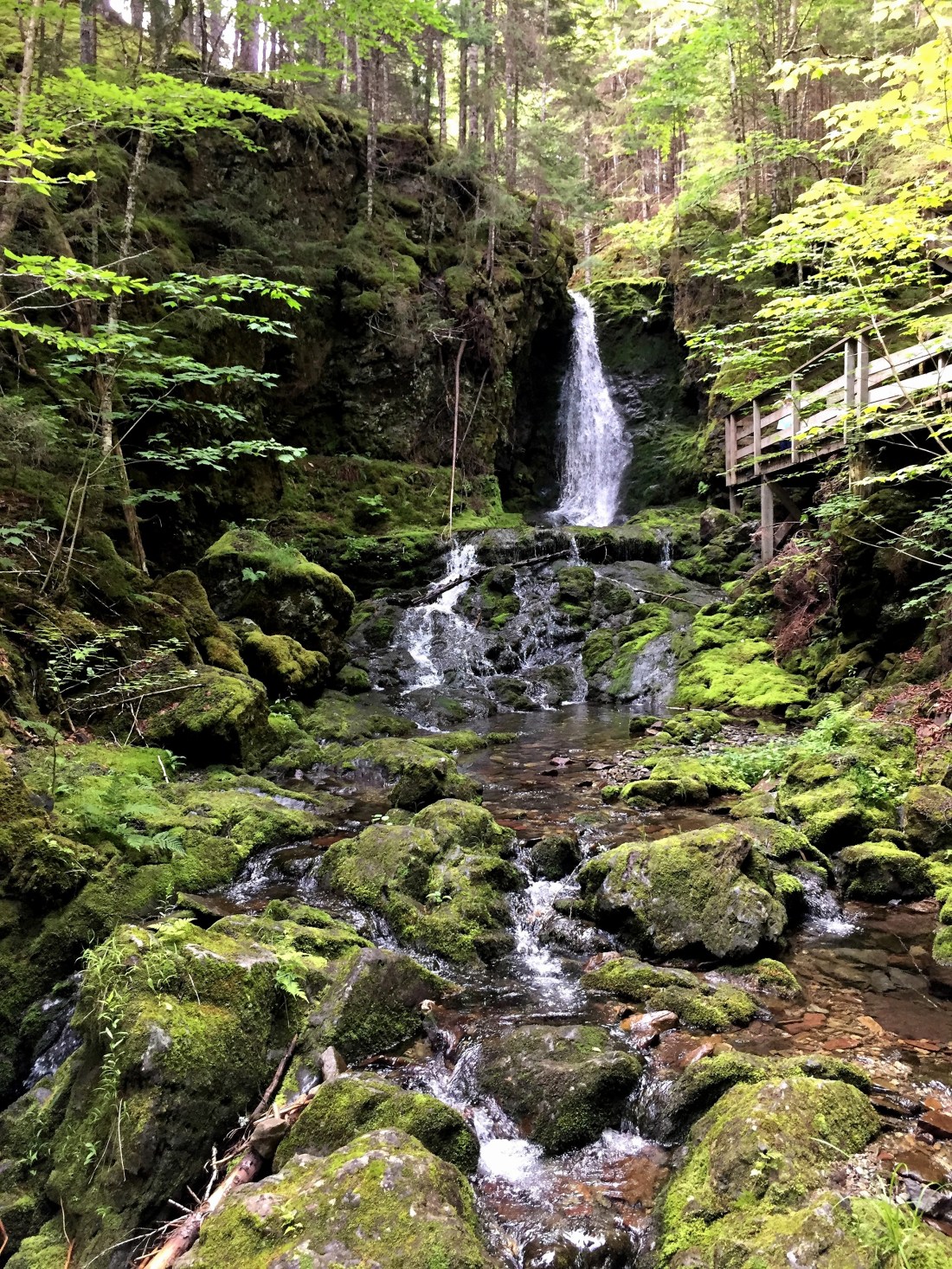
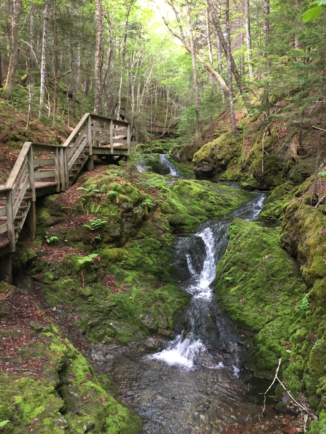
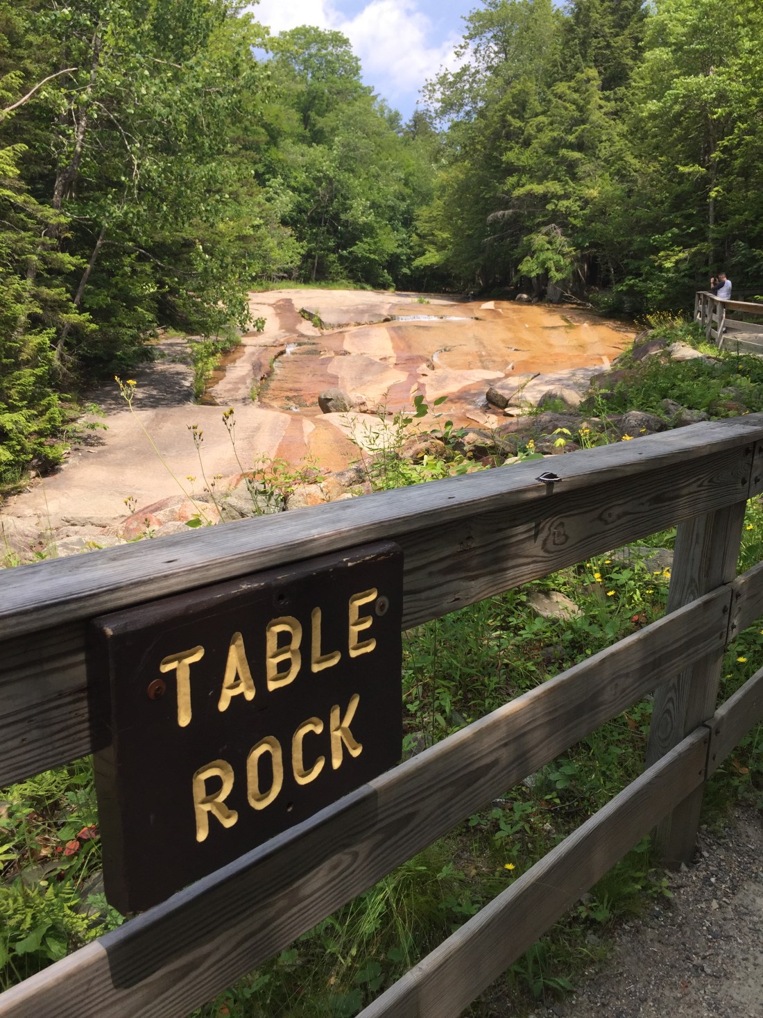
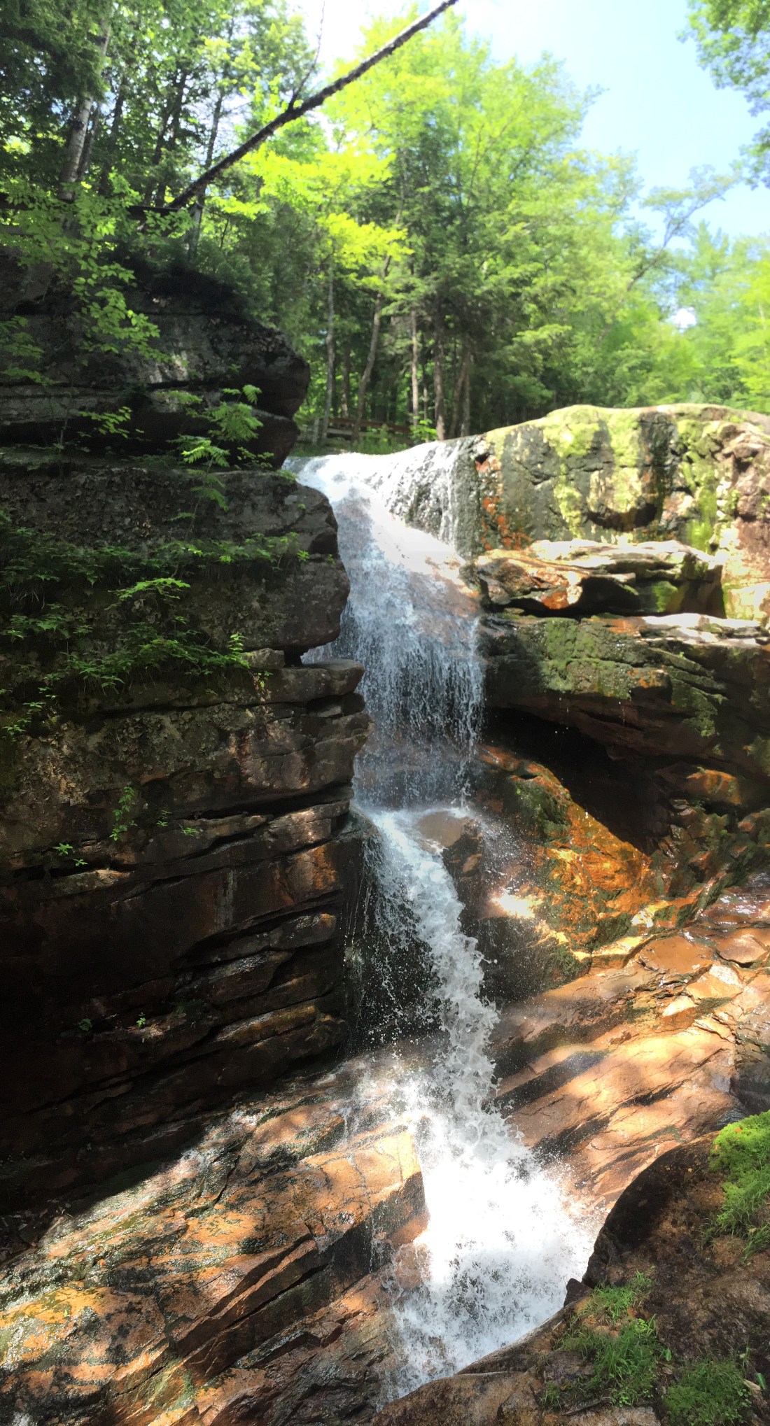
Dickson Falls:  Stopped to hike the falls trail on my drive out.
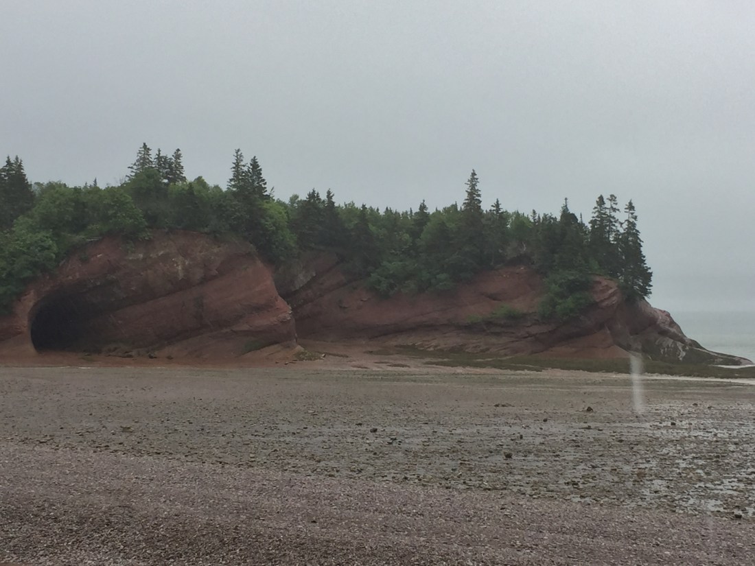
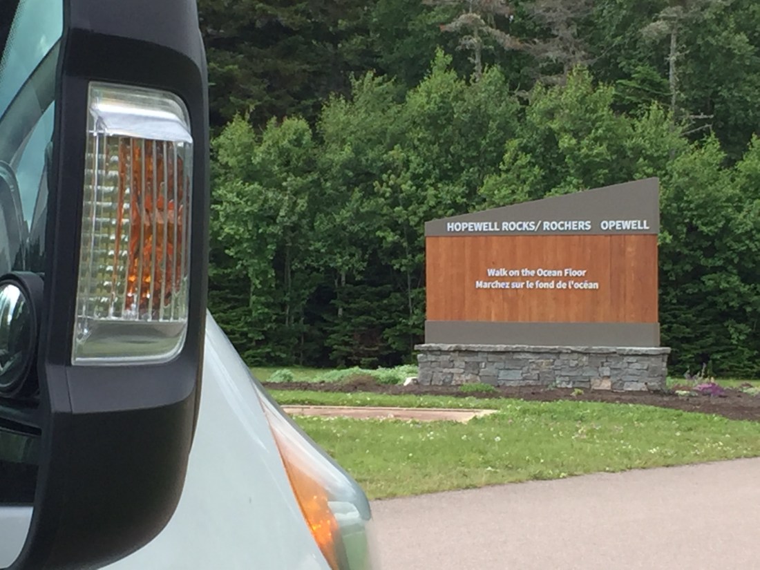
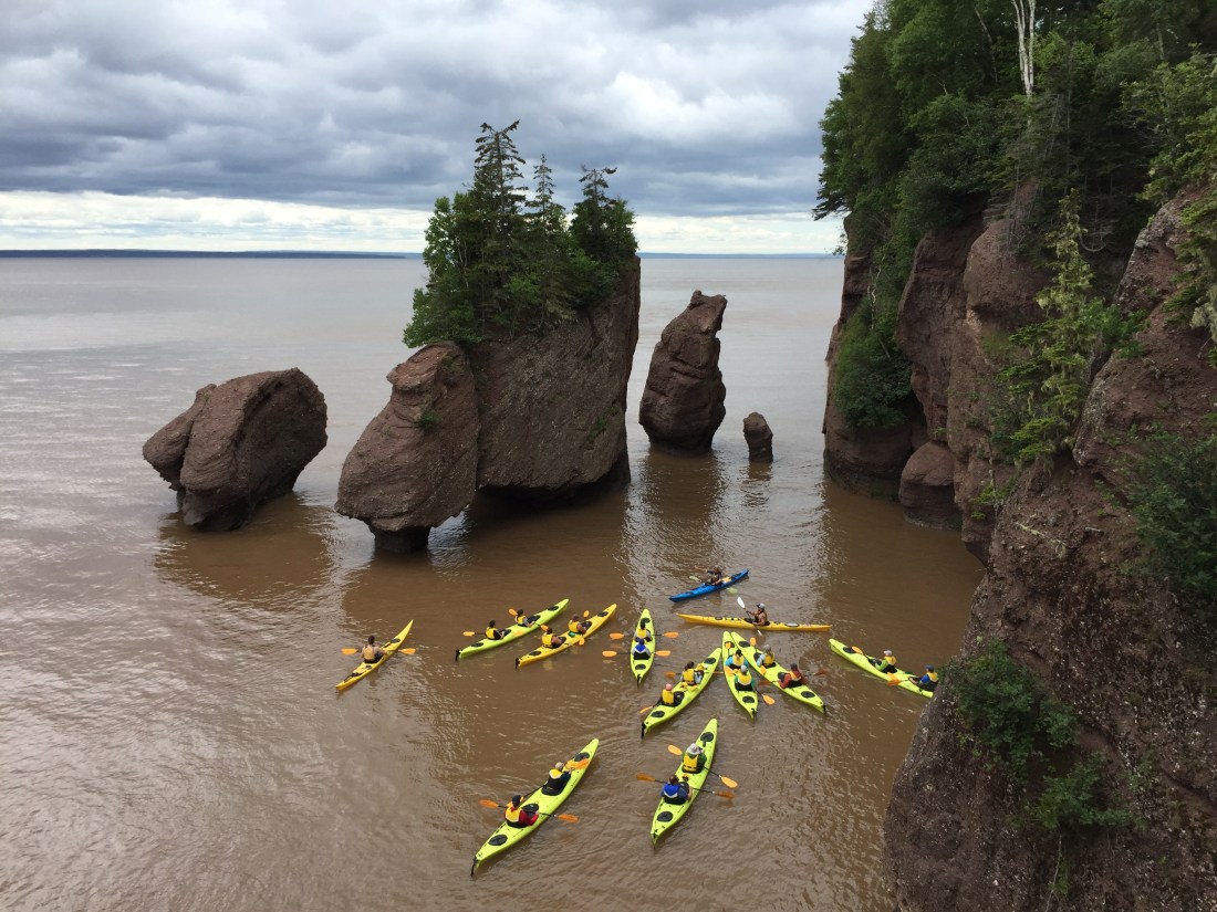
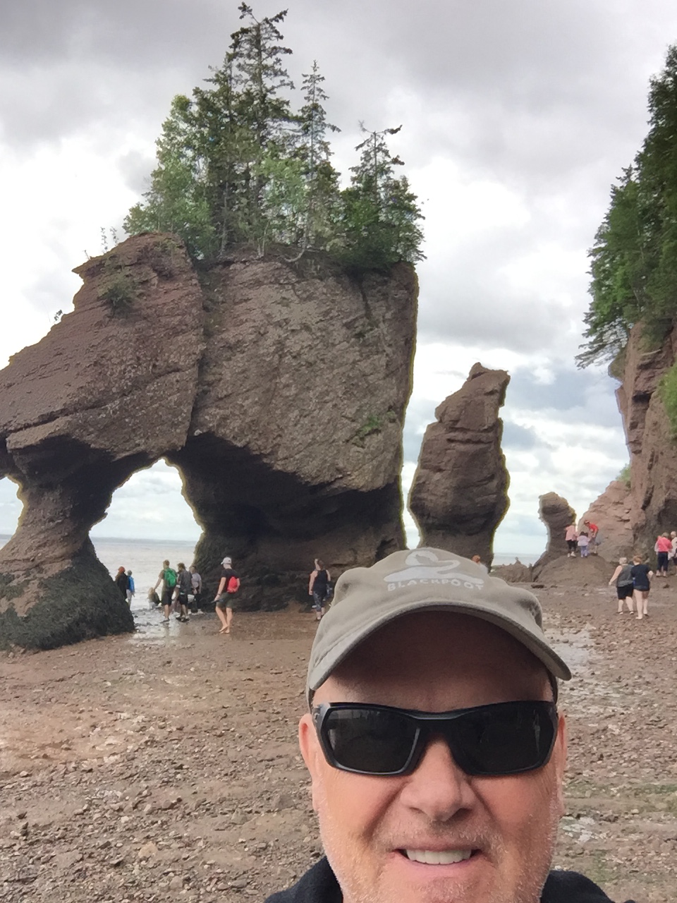
IMG_1934IMG_1939

The Hopewell Rocks:

IMG_1965

The Hopewell Rocks are located on the Bay of Fundy and allow you to experience the world’s highest tides in a dramatic way.  The Lovers Arch formation is a focus area.  At high tides, people kayak at the top of the Arch.  Then only hours later, you can walk under the Arch.  Pretty amazing!

IMG_1942IMG_1959

More pics of the area:


Hopewell Rocks is a popular tourist area, so prepare to share your experience.

As usual, their never seems to be enough time to see and do everything but New Brunswick treated me well.  Now, off to Prince Edward Island!

Franconia Notch State Park, New Hampshire

IMG_1740

Franconia Notch is located in the heart of the New Hampshire White Mountains.   I have visited here before and really enjoy this area.  My first visit was in the 1970’s for a backpacking trip along the Appalachia Trail, which runs along the mountain ridge tops.  The infrastructure surrounding the park has changed significantly since the 1970’s but the beauty of the park remains.

I spent two wonderful nights camped in the park.  My first day included hiking the Flume Gorge area and then finding / setting up a campsite .  The second day, I cycled on the bike paths that run along the Notch.

THE FLUME:

IMG_1757

The Flume is a natural gorge with walls that rise perpendicularly to heights of 70 to 90 feet with widths as tight as 12 to 20 feet.  The trail through the Flume is two miles long and starts and ends at the Visitor Center (ticket needed).  The trails crosses over the Pemigewasset River via a covered bridge on the way to the gorge and then circles back toward the Visitor center on the Ridge Path.

Flume Visitor Center:

IMG_1744

Items of interest along the trail include:

Covered Bridge:

IMG_1749

Table Rock:

IMG_1750

The Flume Gorge and Avalanche Falls :

IMG_1758

The Pool and Sentinel Pine Covered Bridge (a second bridge located on the loop back to visitor center):

IMG_1774IMG_1778IMG_1788

The Flume Gorge area is worth a visit.  The two mile hike is loaded with natural beauty and the state has done a great job of maintaining the area.

CAMP SET UP:

There were a few camping sites available at the Lafayette Place Campground.  I came without reservations, so I got lucky.  The campground has a store and showers.  The campground map highlights a washer and dryer location.  I thought I would do some laundry but I found only a dryer.  I stopped by the store and asked about a washer.  The store attendant smiled and pointed to the river.  He then said “welcome to Franconia Notch”.  I smiled back thinking “this is my kind of place” and we proceeded to talk about things to do in the area.

IMG_1798

Day 2:  

I cycled the bike paths from the campground which take you to various areas with the Notch.

My first stop was the Old Man of the Mountain Historic Site.  A rock formation of granite blocks formed the profile of a man’s face when viewed from the correct angle.  In 2003, the Old Man of the Mountain collapsed.  After the collapse, funds were raised to build the Old Man of the Mountain Memorial and Profiler Plaza.  Using one of the seven “profilers” allows visitors to re-image the profile.  You pick which profiler to use based on your height.

IMG_1799IMG_1801IMG_1803

In some ways pretty cool and other ways kind of nuts!

My second stop was the New England Ski Museum which is located at the base of the Cannon Mountain Ski Area.  The Museum has free admission and has a great display.

IMG_1809

Bode Miller grew up in the area and skied Cannon Mountain.  Many of his Olympic and World Cup medals are displayed in the museum.   Many people say that if you can ski this mountain, you can ski anywhere.  It is know for icy conditions.

IMG_1810

Often people ask about the term “skins” in relation to skiing.  The museum had background information on this.

IMG_1813IMG_1812

Today back country skiers still use skins made of synthetic materials for climbing hills.  The skins are them removed before skiing down.  Yahoo!

I loved the collection of old telemark ski boots.  My originals would fit right into the collection.

IMG_1816

It was a fun visit.  The lady running the museum was very knowledgeable about the displays and the area in general.

Some more pictures from the day which include Echo lake and the Basin West:


These pictures brought back memories of backpacking trips in the White Mountains:


I need to give a shout out to Jim B., a good friend who lives in Connecticut.  I was able to spend an evening (dinner and brews) with Jim and his family on the way to New Hampshire.  It was great seeing him.  Some pics from Jim’s hometown.  Neat area for cycling, which I did before meeting up with Jim.

Next stop New Brunswick, Canada!

Ohio – Family Wedding

IMG_1690

It is always great to make my way back to Ohio to visit family and friends.  Weddings are extra special as it gives me a chance to see many of in one location.  The wedding took place near Mohican State Park.  The majority of the attendees stayed at the State Park Lodge or at the wedding site (which offered cabins and tree houses).

Most people came days prior to the wedding and we mainly gathered around the Lodge swimming pool.  We used this time for drinks and conversing.  Around 25 people, hit the golf course for a tournament one morning, which was quite an event.

Pics from the wedding:

IMG_1686IMG_1682IMG_1694IMG_1692IMG_1699IMG_1701IMG_1704

Some pictures taken around Ohio prior to the wedding:

I was able to meet up with some old friends from the Sydney, Ohio area.

IMG_1645

Speaking of family and friends, this is a good time to “plug” some pictures taken during my Spring time in Colorado.  These include many events – cycling, camping, Meadow Grass Music Festival, Avatar Concert at Black Sheep, step-son’s graduation, Grandparents day, meet up of friends from work days, Rockies game with my buddy Roger. etc.

Next, I am off to visit the Eastern Canadian Provinces!

Springfield, Illinois: Land of Lincoln

IMG_1534

Abraham Lincoln was born in Kentucky in 1809.  His family moved to Indiana in 1816 and then to Illinois in 1830.  While all three states lay a claim to Lincoln, the City of Springfield is the home to the Lincoln Presidential Museum and Library, as well his tomb at Oak Ridge Cemetery.  Springfield is also the Illinois State capital.

My plan called for one full day to check out Springfield.  I found that a person could easily spend three or more days to gather all the sites.  Downtown Springfield is not real bicycle friendly, so I parked in a lot near the Presidential Museum and then walked about from there.

First stop was the Abraham Lincoln Presidential Museum.  This a top notch operation and one could spend a full day here.   I highly recommend a visit!!!!  On my journeys, people have often told me – you need to go to here or there.  Once, I remember asking “why?’ and was told, just go.  That recommendation led to a very special experience. So, versus laying out all the reasons why, let me say, just go.

Some pics from the Museum:

IMG_1533IMG_1532

The downtown area is within a reasonable walking distance.  Some pics:

Old Train station:

IMG_1540IMG_1539IMG_1538

Capital Building:

IMG_1569IMG_1548IMG_1545IMG_1549

Old Capital Building:IMG_1543IMG_1541

Other downtown building, including Governors Mansion:

IMG_1552IMG_1550IMG_1572

My next stop was Lincoln’s home.  He was sitting in this house when he received a visitor telling him that he won the presidency.

IMG_1558IMG_1562

A very nice home for the time, as evidenced by the three “seater” in the back yard.

IMG_1568

By the time I circled back toward the parking area, the Presidential Library was closing in 10 minutes.  A short visit!  The Library is across the road from the Presidential Museum.

IMG_1535

The reason I was a little late for the Library is that a very nice brewery is situated close to the Lincoln home.  Silly me.  However, a few beers did taste well after walking all day.

IMG_1563IMG_1567

Next stop Ohio, for a family wedding.

Jefferson City, Missouri

IMG_1525

In 1821, Jefferson City was chosen as the site for the capital of Missouri.  It is located on the tree lined bluffs of the Missouri River.  Rand McNally named the city as “Americas Most Beautiful Small Town.  The Governors Mansion is shown in the above picture.

Given the small town size, my goal was to bicycle to see the sites.  I parked the van at the Red Wheel Bike Shop which is located near the downtown area.  The shop is housed in a restored red brick building near the river.  I would recommend the shop as they were very friendly, provided maps and information, a derailleur adjustment, and allowed free parking for the day.   IMG_1512

The shop staff noted that the Missouri River had recently overflowed it’s banks and flooded the store.  When it was safe to return, they found catfish swimming inside.  Making the best of the situation, they made up T-shirts for memories.

IMG_3875

The Missouri River was still high at the time of my visit:

IMG_1529

As a start to the day, the bicycle staff recommended a ride on a green way trail along Wears Creek.  This is approximately a 15 mile round trip from the bike shop.  Next, I rode into the downtown area.  The city has many historic buildings and special landmarks.

The capital building dome is under restoration and expected to open in early 2020.

IMG_1514

Post Office Building – Sure makes a statement!

IMG_1516

Old State Penitentiary

IMG_1520

Lewis and Clark Monument at the Lewis and Clark Trail head Plaza:

IMG_1527

Other sites:

Jefferson City had a couple of natural disasters right before my visit.  Along with the flooding, a tornado had recently hit the town.  It was sad to see the damage and repairs were underway:

IMG_1519

Jefferson City is worth a visit.  The town is very bicycle friendly and a person could easily spend a couple days exploring the city.

Now off to Springfield, Illinois and the land of Lincoln.   By the way, still on goal for no interstate highway travel until Ohio.  Traveling the back roads tells a tale of how many small towns are “drying” up.  When Kansas and Missouri were first settled, people did not have today’s infrastructure and means to travel distances.  Towns sprung up to provide local needs.  Many of these towns did not thrive / survive into the changes of the 21’st century.


Kansas – Minus I-70

IMG_1473
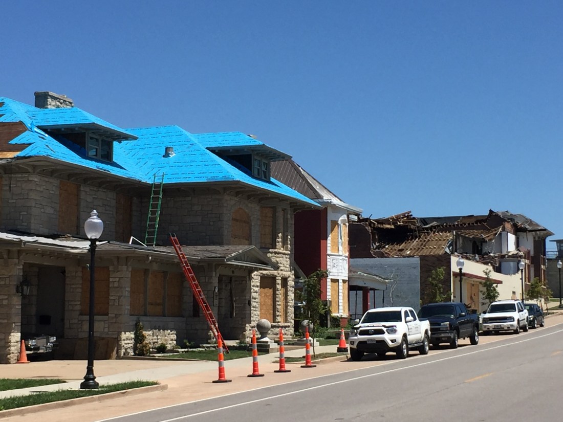
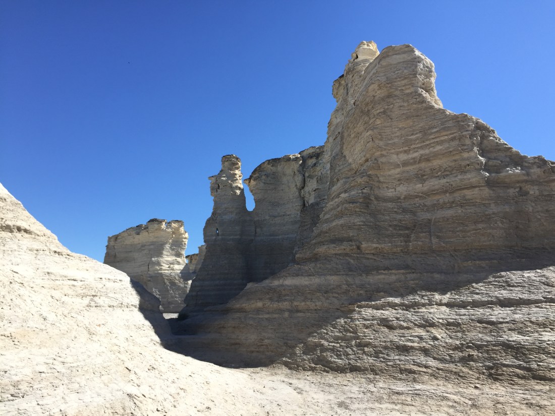
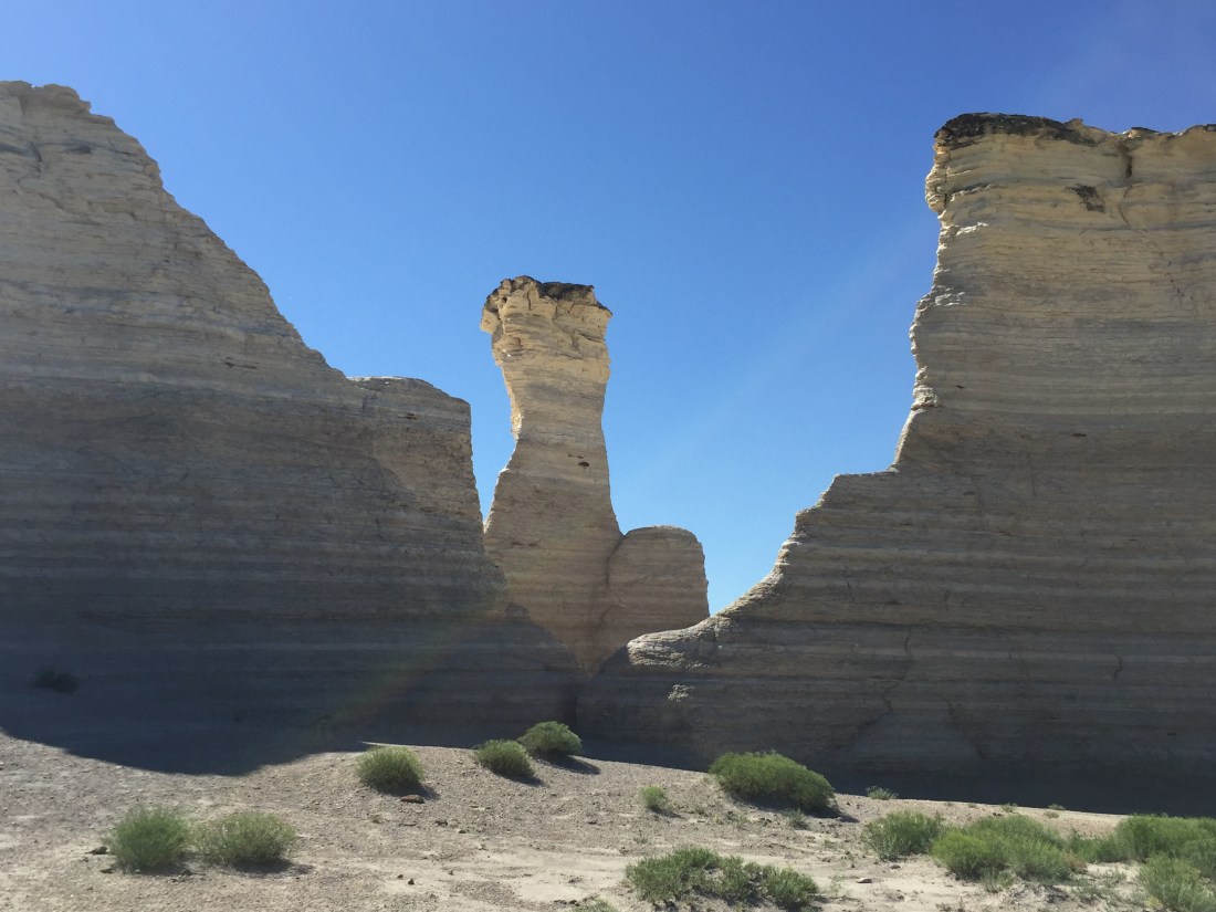
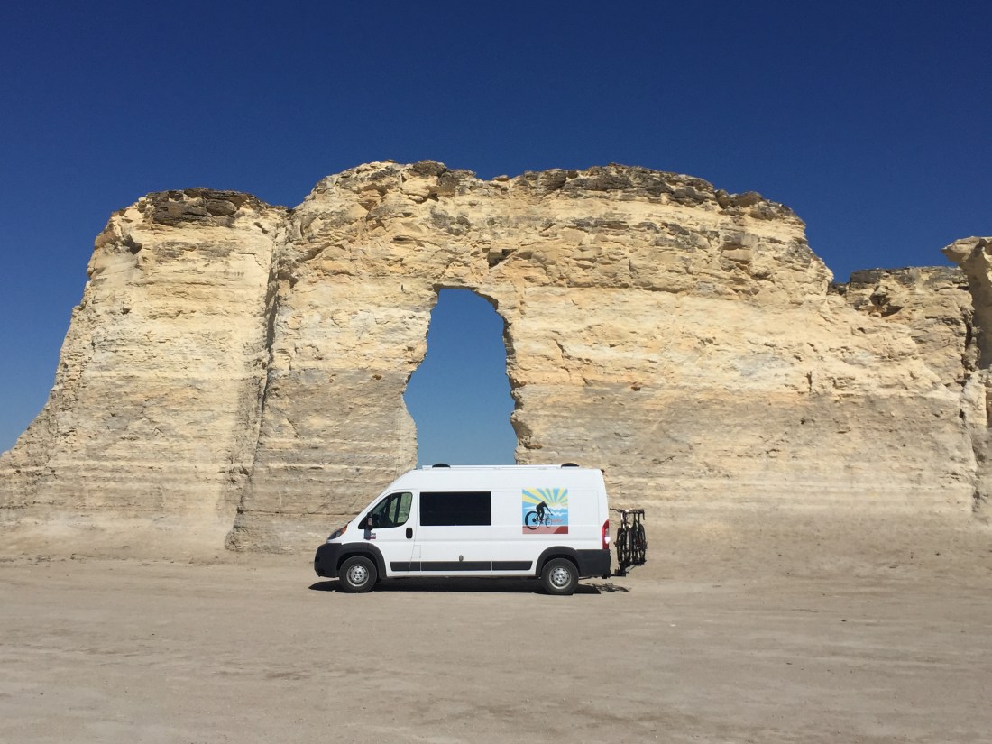
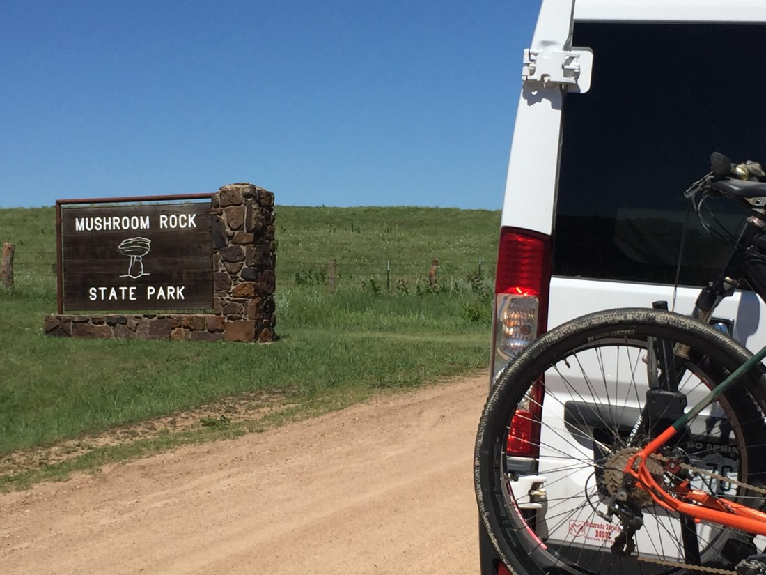
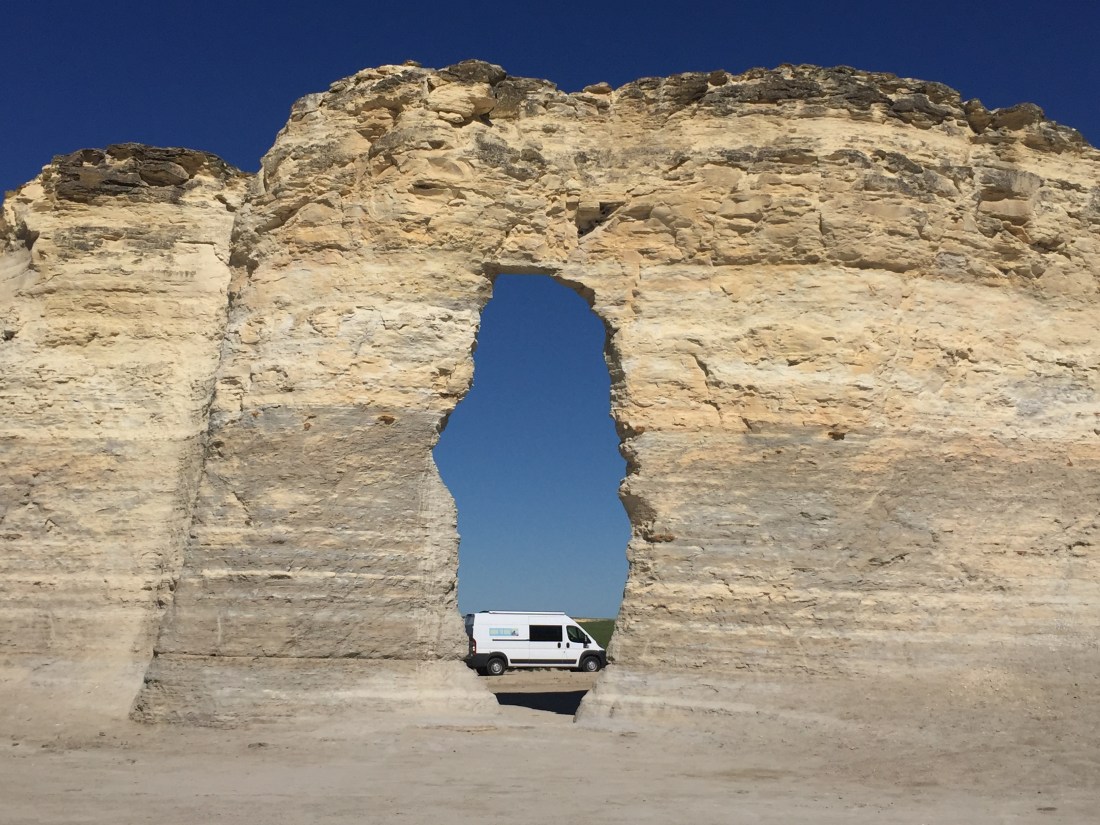
Heading east from Colorado, I normally “speed” through Kansas on I-70, stopping only for gas and eats.  While heading to Ohio for a family wedding, I decided to add some travel time, allowing me to see Kansas via it’s back roads.

IMG_1489

Most people think of Kansas as miles of flat land filled with fields of various crops.  While this is generally an accurate picture, Kansas does offer some surprises.

A) Lake Scott State Park and Wildlife Area

IMG_1449
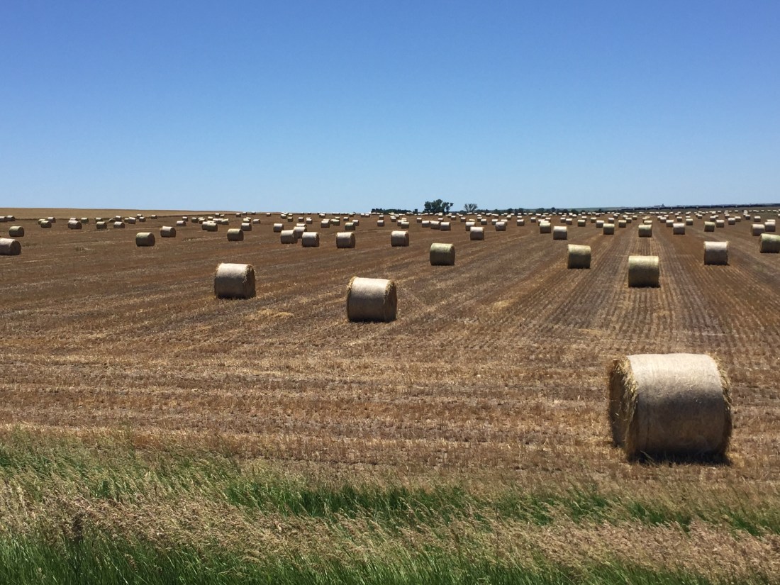
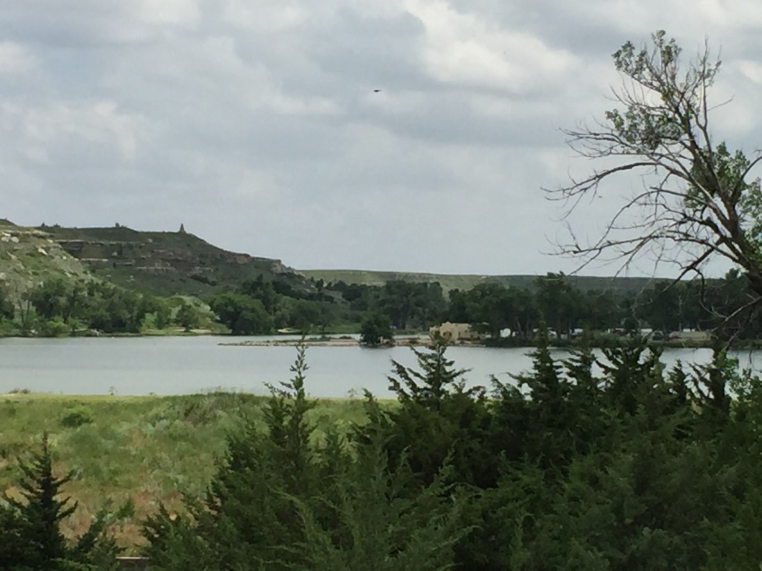
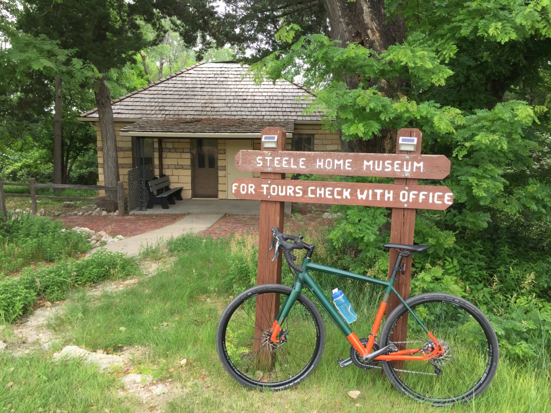
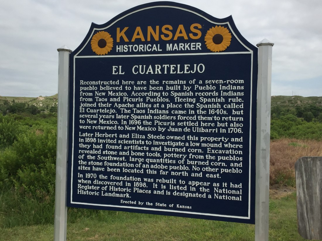
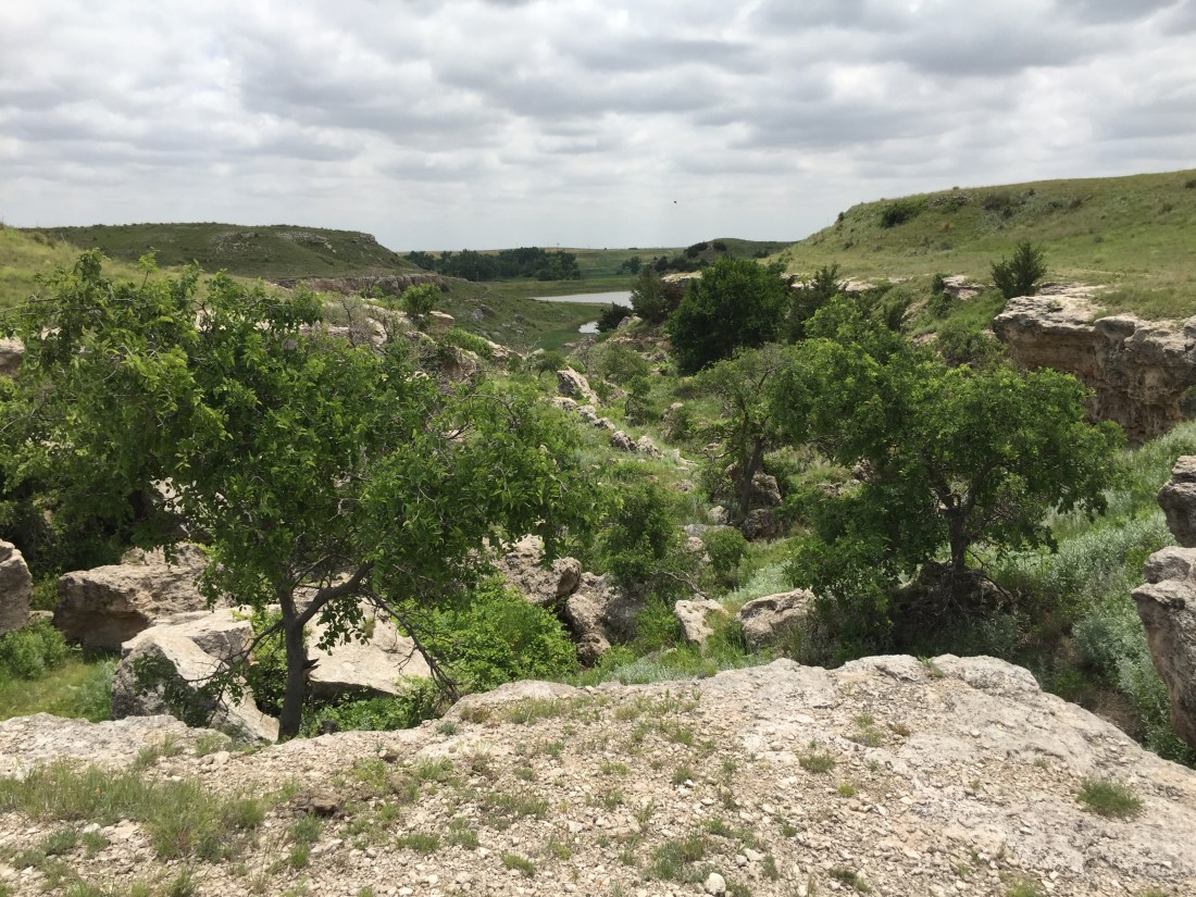
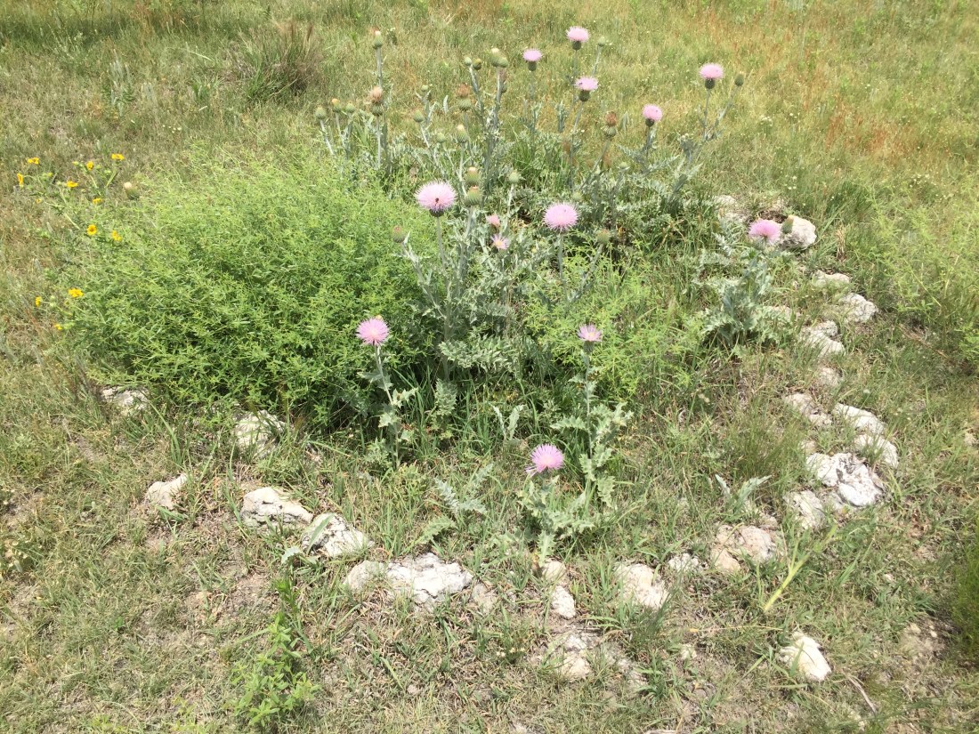
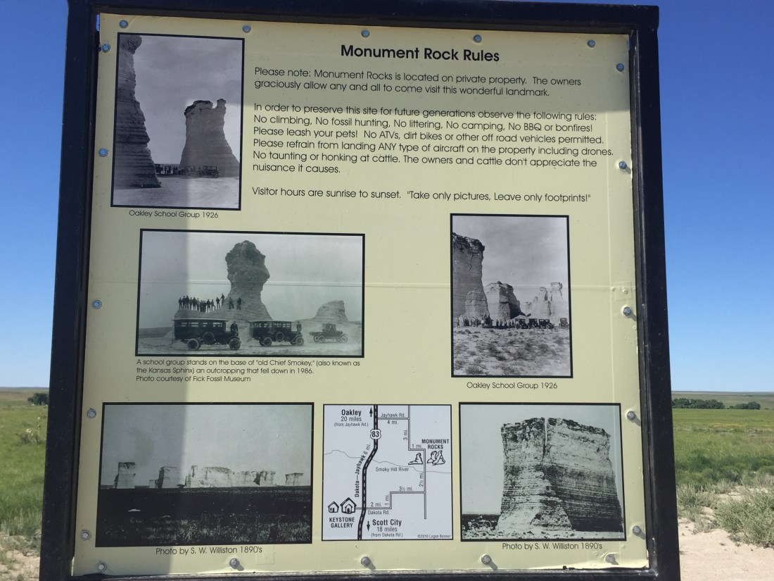
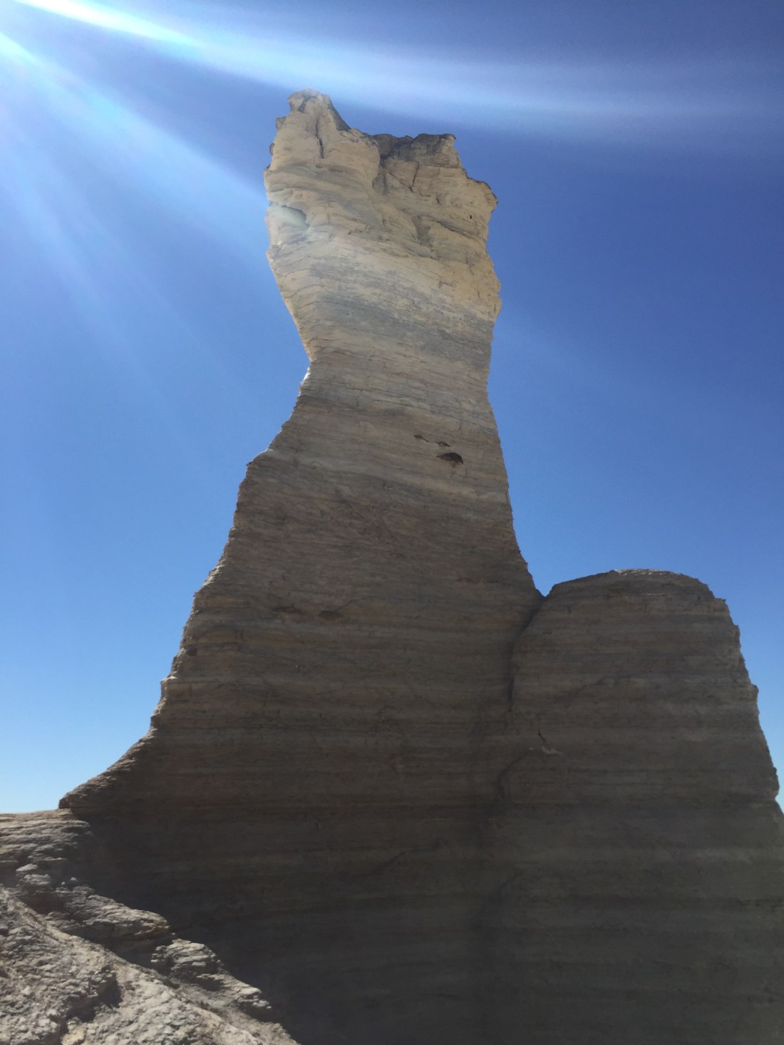
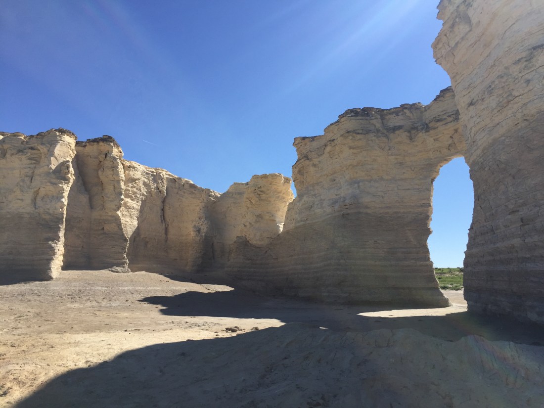
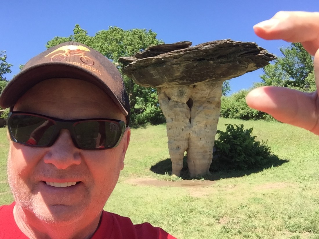
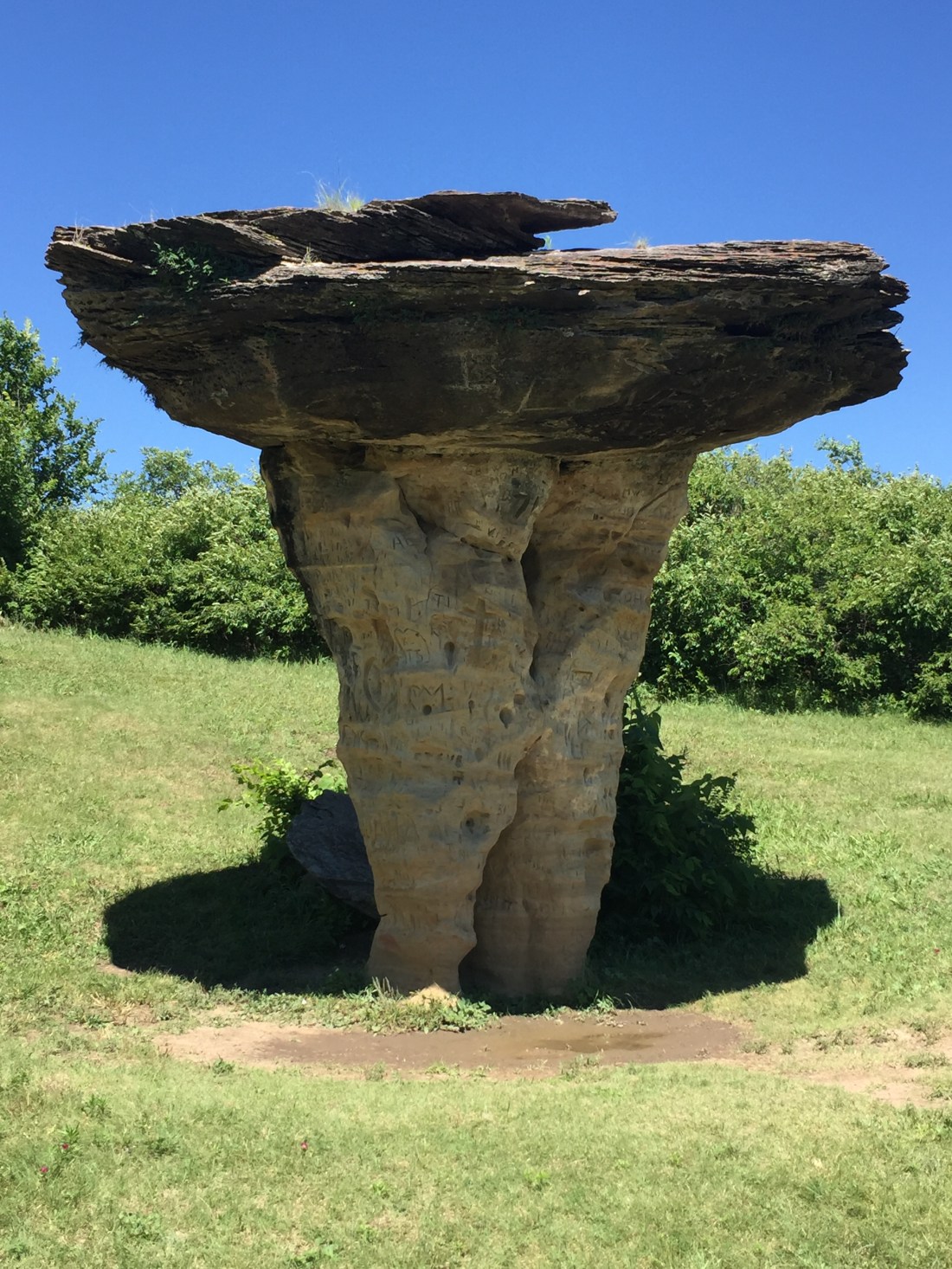
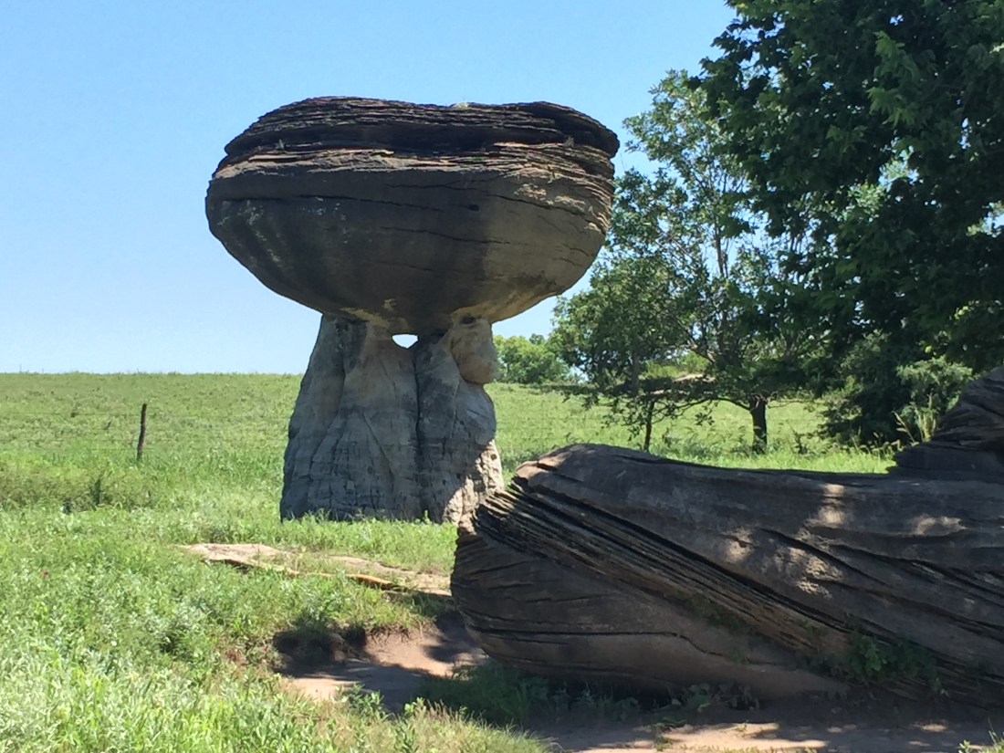
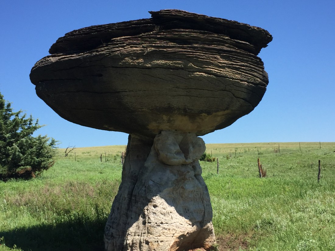
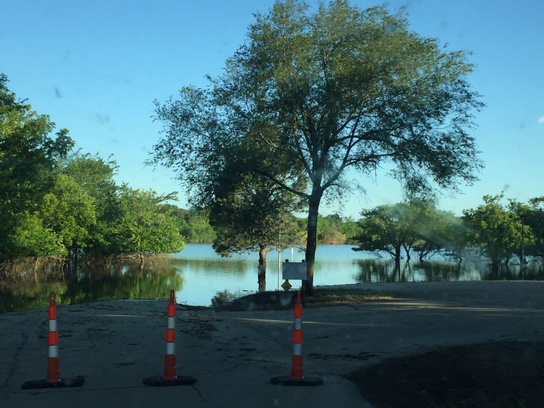
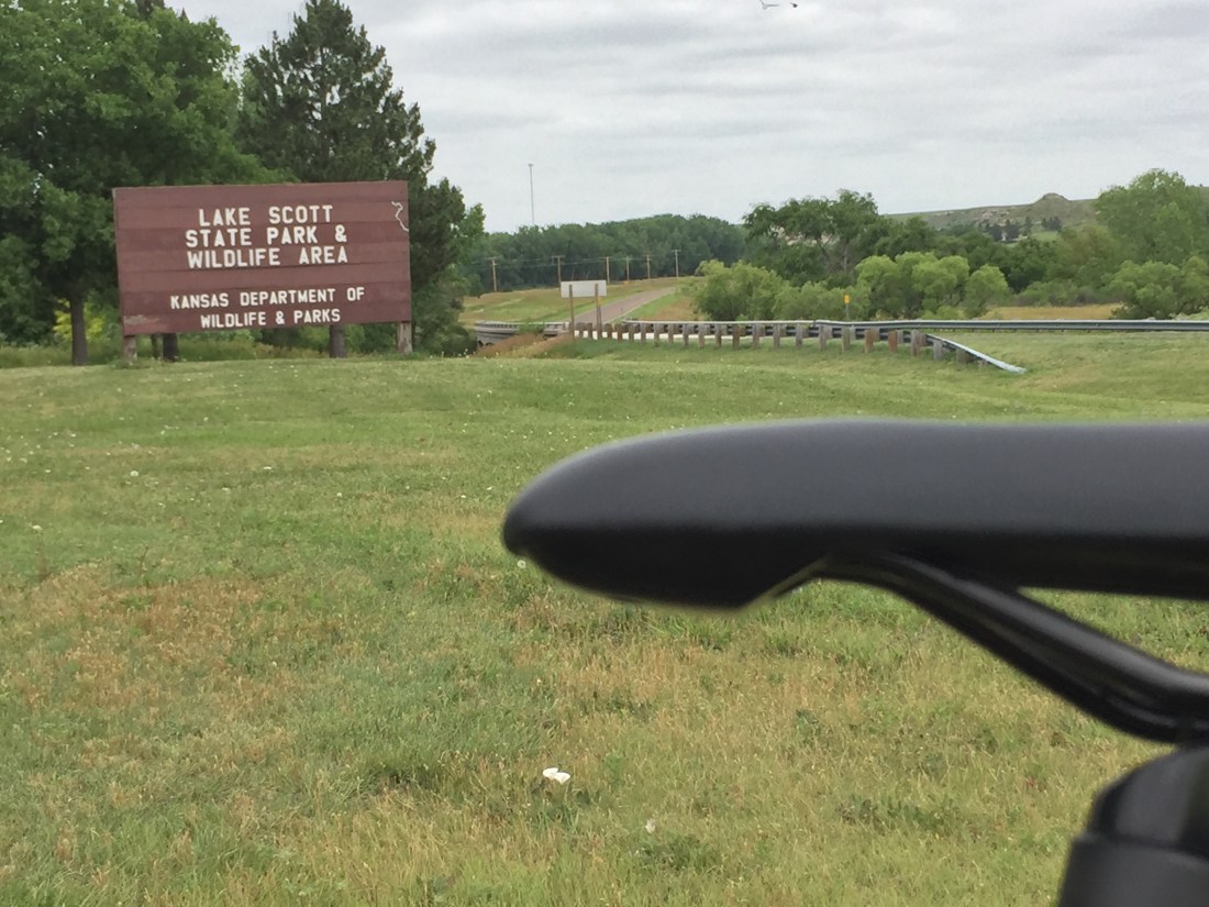
First stop was Lake Scott State Park which provides easy access to a number of areas of interest.  The park has natural springs, deep wooded canyons and craggy bluffs.  A 100 acre lake created by dam construction provides a great setting for boating, swimming, camping, fishing, and hiking /cycling.

IMG_1463

Within (or near) the park are the Steele Homestead Museum, El Cuartelejo Indian Pueblo, and the Battle Site of Punished Woman’s Fork.

Steele Homestead Museum:  Herbert Steele homesteaded the area in 1888 and the Steele home is preserved as a museum.

IMG_1447

El Cuartelejo Indian Pueblo:  In the 1600’s, A group of Taos Indians fled from Spanish rule and migrated to the park area.  They constructed pueblos and lived in the area for around 20 years before returning to New Mexico.  They settled with a band of Plains Apache. This is the the northernmost known pueblo in the United States.

The pueblos were abandoned and then later excavated, investigated and reconstructed by the Kansas State Historical Society.   The present site allows a visitor to see the Pueblo’s reconstructed foundation.

IMG_1445

The El Quartelejo Museum is located in Scott City, not far from the State Park.  It offers many exhibits and artifacts that provide a glimpse of early Native American and Pioneer life.

The Battle of Punished Woman’s Fork:  This battle was the last encounter of Native Americans with the U.S. Calvary in Kansas.  A sad time in U.S. history.   The Northern Cheyenne were sent to Oklahoma were there was little food and no buffalo and at the same time malaria ravaged the the tribe.

In 1878, a number of Northern Cheyenne escaped from the Oklahoma reservation with the goal of returning to their original home in Yellowstone Territory.  They were led by Chief Dull Knife.  The Calvary pursued and Dull knife picked a place called Punished Woman Fork to make a stand, as it offered a remote canyon with a natural cave at the end.  The cave provided a sanctuary for the women and children.  The battle was a stand-off with the Cheyenne slipping away during the darkness of night to resume their way toward the Yellowstone.

View of the Canyon:

IMG_1456

Entry to the battle area and a monument highlighting the battle:


Cave at end of canyon:

Cheyenne Rifle Pits locations are still visible:

IMG_1460

B)  Monument Rocks:

Monument Rocks is the site of the first Natural Landmark in Kansas as designated by the Department of Interior.  The limestone formations rise 50 feet above the prairie and are one of the 8 wonders of Kansas. Note, the rocks are reached via dirt roads. I recommend taking the roads when they are dry.  Keystone Gallery near the rocks is worth a stop.

The pictures speak for themselves:

IMG_1471

IMG_1484IMG_1477IMG_1481IMG_1486IMG_1472

C: Cheyenne Bottoms:

Cheyenne Bottoms Wildlife Area is one of the Continent’s busiest flyways for migrating waterfowl and shorebirds, with 357 species.

D: Mushroom Rock State Park:

This park is tucked into the Smokey Hills Region of North-Central Kansas.  It is one of the 8 Wonders of Kansas Geography.  It is a 5 acre park for day-use only.  It is a satellite of Kanopolis State Park.

I had reservations to camp at Kanopolis State Park but the park was flooded out during my visit and was closed.  The Missouri and Mississippi Rivers were in flood stage.  As the Kansas rivers feed into these to drainage’s,  the State was holding back as much water as possible via dammed controlled lakes.  I ended up staying at Pomona State Park which was open but also flooded.

IMG_1495IMG_1497IMG_1500IMG_1503IMG_1505

IMG_1509

State Park Flooding:

IMG_1511

My back road Kansas visit provided a different perspective to the State.  On to Missouri!!